AKA: none
Other ID: G-01-13-GA,2013-013-FA
Status: Completed
Organization(s): USGS, Pacific Coastal and Marine Science Center
Funding Program(s): Coastal and marine earthquake, tsunami, and landslide active margin field studies (ZP00EQV)
Principal Investigator(s): Thomas Parsons
Affiliate Investigator(s):
Information Specialist(s): Thomas Parsons
Data Type(s): Seismics: Sparker, Location-Elevation: Navigation, Seismics: Boomer
Scientific Purpose/Goals: High res seismic refelection and chirp data collection around IODP hole in Port Valdez
Vehicle(s):
Start Port/Location: Valdez
End Port/Location: Valdez
Start Date: 2013-09-03
End Date: 2013-09-13
Equipment Used: multichannel , navigation, chirp
Information to be Derived: Sedimentary structure of landslide deposits
Summary of Activity and Data Gathered:
Staff: Jackson Currie, Peter Dal Ferro, Patrick Hart, Thomas Parsons, Holly Ryan, Robert Wyland, Jonathan Childs
Affiliate Staff:
Peter Haeussler
Emily Roland
Rob Wesson
Chuck Worley
Notes: Staff information imported from InfoBank
Peter Haeussler
Pat Hart
Tom Parsons
Emily Roland
Jon Childs
Rob Wyland
Pete Dal Ferro
Jackson Currie
Rob Wesson
Chuck Worley
Holly Ryan
Location:
Alaska
| Boundaries | |||
|---|---|---|---|
| North: 61.75 | South: 54.25 | West: -155.75 | East: -132.25 |
Platform(s):
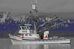
 Alaskan Gyre |
Balster-Gee, A.F., Hart, P.E., Sliter, R.W., and Parsons, T.E., 2020, Chirp, multichannel minisparker, and boomer seismic-reflection data from USGS field activity G-01-13-GA collected in Port Valdez, Alaska, in September 2013: U.S. Geological Survey data release, https://doi.org/10.5066/P92R2I8J.
| Survey Equipment | Survey Info | Data Type(s) | Data Collected |
|---|---|---|---|
| multichannel | --- | Sparker | Multichannel minisparker and boomer seismic-reflection data from USGS field activity G-01-13-GA collected in Port Valdez, Alaska, in September 2013 (Multichannel minisparker and boomer seismic-reflection data were collected by the U.S. Geological Survey in September of 2013 in Port Valdez, Alaska. Data were collected aboard the USGS R/V Alaskan Gyre during field activity G-01-13-GA, using a 500-Joule SIG 2-mille minisparker or an Applied Acoustics triple plated S-Boomer sound source and a 24-channel Goemetrics hydrophone streamer. Sub-bottom acoustic penetration spans several hundreds of meters and is variable by location.) |
| navigation | --- | Navigation | |
| chirp | --- | Boomer | Chirp seismic-reflection data collected in Port Valdez, Alaska, in September 2013 (Chirp data were collected by the U.S. Geological Survey in September of 2013 in Port Valdez, Alaska. Data were collected aboard the USGS R/V Alaskan Gyre during field activity G-01-13-GA, using an EdgeTech SB-512i sub-bottom profiler. Sub-bottom acoustic penetration spans several tens of meters and is variable by location.) |