AKA: none
Other ID: G-1-70-CS,G-1-70-AR
Status: Completed
Organization(s):
Funding Program(s):
Principal Investigator(s): Art Grantz
Affiliate Investigator(s):
Information Specialist(s):
Data Type(s): Electro-Magnetic: Magnetics, Environmental Data: Current, Environmental Data: Density, Environmental Data: Turbidity, Imagery: Photo, Location-Elevation: Navigation, Sampling: Biology, Sampling: Geology, Seismics: Air Gun / Water Gun, Seismics: Sparker, Sonar: Sidescan
Scientific Purpose/Goals: To provide background data for interpreting ecological relationships, to locate and define these relationships, and to outline the processes of sediment transport and deposition.
Vehicle(s):
Start Port/Location:
End Port/Location:
Start Date: 1970-09-01
End Date: 1970-10-18
Equipment Used: sidescansonar, sparker, magnetics, underwatercamera, handsamplegrab, boxcore, currentmeter, gravitycore, pistoncore, VanVeengrab, Shipekgrab, hydrometer, Secchidisc, transmissometer, navigation, airgun
Information to be Derived: Sediment-tranport processes with near-bottom current measurements and water column turbidity determinations. Analyses for mercury, arsenic, copper, lead, and zinc, and hydrocarbon content.
Summary of Activity and Data Gathered: physical data holdings
Staff: Peter Barnes
Affiliate Staff:
Notes: Staff information imported from InfoBank
Art Grantz (USGS Western Region) - Chief Scientist
Peter Barnes (USGS Western Region) - Scientist
Roberge (USCG Glacier) - Ship Captain
Location:
Chukchi Sea
| Boundaries | |||
|---|---|---|---|
| North: 72 | South: 65 | West: 174.75 | East: -156 |
Platform(s):
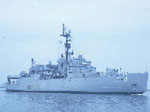
 Glacier |
Barnes, P.W., 1972, Preliminary results of geologic studies in the Eastern Central Chuckchi Sea, in An Ecological Survey in the Eastern Chukchi Sea September-October 1970: U.S. Coast Guard Oceanographic Report no. 50, pp. 87–91.
Grantz, A., Hanna, W.F., and Wallace, S.L., 1971, Chukchi Sea seismic reflection profiles and magnetic data, 1970, between northern Alaska and Herald Island, 37 sheets, scale 1:100,000: U.S. Geological Survey Open-File Report 71-125, http://pubs.er.usgs.gov/publication/ofr71125.
| Survey Equipment | Survey Info | Data Type(s) | Data Collected |
|---|---|---|---|
| sidescansonar | --- | Sidescan | |
| sparker | --- | Sparker | Scan g-1-70-cs.full.2.tif Scan g-1-70-cs.full.1.tif Scan g-1-70-cs.small.1.tif Scan g-1-70-cs.small.2.tif |
| magnetics | --- | Magnetics | |
| underwatercamera | --- | Video Photo | |
| handsamplegrab | --- | Geology | Station Information |
| boxcore | --- | Biology Geology | |
| currentmeter | --- | Current | |
| gravitycore | --- | Geology | |
| pistoncore | --- | Geology | |
| VanVeengrab | --- | Geology | |
| Shipekgrab | --- | Geology | |
| hydrometer | --- | Density | |
| Secchidisc | --- | Turbidity | |
| transmissometer | --- | Turbidity | |
| navigation | --- | Navigation | Integrated navigation (SINS) data g-1-70-cs.050 Integrated navigation (SINS) data g-1-70-cs.051 (Provisional best file) Best file with nav in ArcInfo E00 format |
| airgun | --- | Air Gun / Water Gun |