AKA: none
Other ID: G-2-86-MS
Status: Completed
Organization(s):
Funding Program(s): Gulf of Cadiz (MU131)
Principal Investigator(s): Monty Hampton, Victor Diaz
Affiliate Investigator(s):
Information Specialist(s):
Data Type(s): Location-Elevation: Navigation, Sampling: Biology, Sampling: Chemistry, Sampling: Geology
Scientific Purpose/Goals:
Vehicle(s):
Start Port/Location:
End Port/Location:
Start Date: 1986-07-10
End Date: 1986-07-15
Equipment Used: navigation, samples
Information to be Derived:
Summary of Activity and Data Gathered:
Staff: Victor Diaz
Affiliate Staff:
Notes:
Staff information imported from InfoBank
Monty Hampton (USGS Western Region) - Chief Scientist
Victor Diaz (Rio, Chief Scientist) - del
Location:
Gulf of Cadiz
| Boundaries | |||
|---|---|---|---|
| North: 37.10383 | South: 36.16567 | West: -7.4293 | East: -6.344 |
Platform(s):
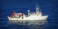 Garcia Del Cid |
| Survey Equipment | Survey Info | Data Type(s) | Data Collected |
|---|---|---|---|
| navigation | --- | Navigation | Best file with nav in ArcInfo E00 format Integrated navigation (SINS) data g-2-86-ms.050 Integrated navigation (SINS) data g-2-86-ms.051 (Provisional best file) |
| samples | --- | Biology Chemistry Geology | Station Information |
