AKA: DSDP29GC
Other ID: none
Status: Completed
Organization(s): USGS, Pacific Coastal and Marine Science Center
Funding Program(s): Deep Sea Drilling Project (MU082)
Principal Investigator(s):
Affiliate Investigator(s): R. Houtz J.P. Kennett
Information Specialist(s):
Data Type(s): Electro-Magnetic: Magnetics, Location-Elevation: Navigation, Seismics: Air Gun / Water Gun, Sonar: Single Beam
Scientific Purpose/Goals:
Vehicle(s):
Start Port/Location: Lyttleton, New Zealand
End Port/Location: Wellington, New Zealand
Start Date: 1973-03-02
End Date: 1973-04-17
Equipment Used: magnetics, transitsatellite, airgun, 12khz, bathymetry
Information to be Derived:
Summary of Activity and Data Gathered: Core Data from the Deep Sea Drilling Project, Leg 29: http://www.ngdc.noaa.gov/mgg/geology/dsdp/data/29/leg29.htm
Staff:
Affiliate Staff:
Notes:
Location:
Western Pacific
| Boundaries | |||
|---|---|---|---|
| North: -40.04331644 | South: -49.54512686 | West: 143.3364 | East: 174.57666001 |
Platform(s):
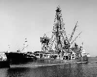 Glomar Challenger |
| Survey Equipment | Survey Info | Data Type(s) | Data Collected |
|---|---|---|---|
| magnetics | --- | Magnetics | |
| transitsatellite | --- | Navigation | |
| airgun | --- | Air Gun / Water Gun | |
| 12khz | --- | Single Beam | |
| bathymetry | --- | Single Beam |
