AKA: none
Other ID: G-3-88-MS
Status: Completed
Organization(s):
Funding Program(s): Gulf of Cadiz (MU131)
Principal Investigator(s): Hans Nelson
Affiliate Investigator(s):
Information Specialist(s):
Data Type(s): Seismics: Air Gun / Water Gun, Sonar: Sidescan, Seismics: Sub Bottom Profiler
Scientific Purpose/Goals:
Vehicle(s):
Start Port/Location:
End Port/Location:
Start Date: 1988-08-11
End Date: 1988-08-18
Equipment Used: airgun, sidescansonar, 3.5khz
Information to be Derived:
Summary of Activity and Data Gathered:
Staff:
Affiliate Staff:
Notes:
Staff information imported from InfoBank
Hans Nelson (USGS Western Region) - Chief Scientist
Maldonado - Chief Scientist
Location:
Gulf of Cadiz
| Boundaries | |||
|---|---|---|---|
| North: 46.75 | South: 28.25 | West: -9.75 | East: 39.75 |
Platform(s):
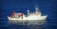 Garcia Del Cid |
| Survey Equipment | Survey Info | Data Type(s) | Data Collected |
|---|---|---|---|
| airgun | --- | Air Gun / Water Gun | |
| sidescansonar | --- | Sidescan | |
| 3.5khz | --- | Sub Bottom Profiler |
