AKA: DSDP40GC
Other ID: Leg 40, hole 360-365
Status: Completed
Organization(s): USGS, Pacific Coastal and Marine Science Center, Leibniz Institute for Baltic Sea Research, Warnemünde
Funding Program(s):
Principal Investigator(s):
Affiliate Investigator(s):
Information Specialist(s): Jim Gardner
Data Type(s): Sampling: Geology
Scientific Purpose/Goals:
Vehicle(s):
Start Port/Location: Cape Town, South Africa
End Port/Location: Abidjan, Ivory Coast
Start Date: 1974-12-01
End Date: 1975-02-28
Equipment Used: drillcore
Information to be Derived:
Summary of Activity and Data Gathered: physical holdings in warehouse 1030 O'Brien
Staff:
Affiliate Staff:
Notes: https://www.ngdc.noaa.gov/mgg/geology/dsdp/data/40/leg40.htm
360 -35.8458 18.0965
361 -35.0662 15.4485
362 -19.7575 10.5325
362A -19.7575 10.5325
363 -19.6458 9.0467
364 -11.5720 11.9717
365 -11.6517 11.8953
Location:
Southwest Africa
| Boundaries | |||
|---|---|---|---|
| North: -10.66060795 | South: -37.43997405 | West: 4.921875 | East: 18.98461694 |
Platform(s):
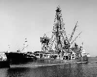 Glomar Challenger |
| Survey Equipment | Survey Info | Data Type(s) | Data Collected |
|---|---|---|---|
| drillcore | --- | Geology |
