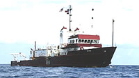
AKA: none
Other ID: GYRE80-4,G-4-80-GM
Status: Completed
Organization(s): USGS, Corpus Christi, TX
Funding Program(s): Continental Slope Studies, Mississippi Delta (MU067)
Principal Investigator(s): Arnold Bouma
Affiliate Investigator(s):
Information Specialist(s):
Data Type(s): Location-Elevation: Navigation, Sampling: Geology, Seismics: Sub Bottom Profiler
Scientific Purpose/Goals: Geophysics, sampling
Vehicle(s):
Start Port/Location:
End Port/Location:
Start Date: 1980-05-18
End Date: 1980-06-01
Equipment Used: navigation, samples, seismic
Information to be Derived:
Summary of Activity and Data Gathered:
Staff: Arnold Bouma, Janet Burke, John Dillon, Gail Erlebacher
Affiliate Staff:
Chuck Stelting (USGS Corpus Christi) - Unspecified
Dick Sylwester (USGS Woods Hole) - Unspecified
Les Shepard (TAMU) - Unspecified
Theo Duis (TAMU) - Unspecified
Mary Feeley (TAMU) - Unspecified
Wayne Fissette (URI) - Unspecified
Don Armand (Texas AM) - Captain
Notes: Staff information imported from InfoBank
Arnold Bouma (USGS Corpus Christi) - Chief Scientist
Jack Kindinger (USGS Corpus Christi) - Unspecified
Jo Ann Charba (USGS Corpus Christi) - Unspecified
John West (USGS Corpus Christi) - Unspecified
James Willingham (USGS Corpus Christi) - Unspecified
Richard Farrow (USGS Corpus Christi) - Unspecified
Tom Rice (USGS Corpus Christi) - Unspecified
Chuck Stelting (USGS Corpus Christi) - Unspecified
John Dillon (USGS Woods Hole) - Unspecified
Barry Irwin (USGS Woods Hole) - Unspecified
Janet Burke (USGS Woods Hole) - Unspecified
Dick Sylwester (USGS Woods Hole) - Unspecified
Les Shepard (TAMU) - Unspecified
Theo Duis (TAMU) - Unspecified
Mary Feeley (TAMU) - Unspecified
Wayne Fissette (URI) - Unspecified
Gail Erlebacher - LSU
Don Armand (Texas AM) - Captain
Location:
Gulf Mexico
| Boundaries | |||
|---|---|---|---|
| North: 28 | South: 26.5 | West: -95.5 | East: -90 |
Platform(s):
 Gyre |
| Survey Equipment | Survey Info | Data Type(s) | Data Collected |
|---|---|---|---|
| navigation | --- | Navigation | Global positioning system (GPS) data g-4-80-gm.061 (Provisional best file) Best file with nav in ArcInfo E00 format |
| samples | --- | Biology Chemistry Geology | |
| seismic | --- | Sub Bottom Profiler |