AKA: DSDP_Leg_61, G-61-78-NP
Other ID: none
Status: Completed
Organization(s): Scripps Institution Of Oceanography, La Jolla, Ca
Funding Program(s):
Principal Investigator(s):
Affiliate Investigator(s): R. Larson, S. Schlanger
Information Specialist(s):
Data Type(s): Electro-Magnetic: Magnetics, Location-Elevation: Navigation, Sampling: Geology, Sonar: Single Beam
Scientific Purpose/Goals:
Vehicle(s): None
Start Port/Location: Apra, Guam
End Port/Location: Majuro Atoll, Marshall Islands
Start Date: 1978-05-22
End Date: 1978-07-29
Equipment Used: magnetometer, transitsatellite, core, 12khz, bathymetry
Information to be Derived:
Summary of Activity and Data Gathered: data holdings publications: Batiza, Rodey, Shcheka, Sergey, Tokuyama, Hidekazu, Muehlenbachs, K., Vallier, T.L., Lee-Wong, F., Seifert, Karl E., Windom, K.E., Book, P., and Fujii, Naoyuki 1981, Summary and index to petrologic and geochemical studies of Leg 61 basalts, in Shambach, James, and Stout, Larry N., eds., Leg 61 of the cruises of the drilling vessel Glomar Challenger; Apra, Guam to Majuro Atoll, Marshall Islands; May-July 1978 [modified]: Initial Reports of the Deep Sea Drilling Project, v. 61, p. 829-839. Core Data from the Deep Sea Drilling Project, Leg 61: http://www.ngdc.noaa.gov/mgg/geology/dsdp/data/61/leg61.htm
Staff:
Affiliate Staff:
Notes: FAN created from InfoBank on 11/15/2018 by CR
Location:
Guam
| Boundaries | |||
|---|---|---|---|
| North: 14.34954784 | South: 7.62388685 | West: 142.99931707 | East: 158.4679461 |
Platform(s):
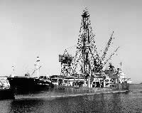 Glomar Challenger |
| Survey Equipment | Survey Info | Data Type(s) | Data Collected |
|---|---|---|---|
| magnetometer | --- | Magnetics | |
| transitsatellite | --- | Navigation | |
| core | --- | Biology Geology | |
| 12khz | --- | Single Beam | |
| bathymetry | --- | Single Beam |
