AKA: DSDP64GC
Other ID: none
Status: Completed
Organization(s): USGS, Pacific Coastal and Marine Science Center
Funding Program(s):
Principal Investigator(s):
Affiliate Investigator(s): J.R. Curray, D.G. Moore
Information Specialist(s):
Data Type(s): Electro-Magnetic: Magnetics, Location-Elevation: Navigation, Seismics: Air Gun / Water Gun, Sonar: Single Beam, Seismics: Sub Bottom Profiler
Scientific Purpose/Goals:
Vehicle(s):
Start Port/Location: Mazatlan, Mexico
End Port/Location: Long Beach, CA
Start Date: 1978-12-01
End Date: 1979-01-14
Equipment Used: magnetics, transitsatellite, 12khz, 3.5khz, airgun
Information to be Derived:
Summary of Activity and Data Gathered: data holdings
Staff:
Affiliate Staff:
Notes: Added FAN from InfoBank; analog holdings
Location:
Gulf of California, Mexico
| Boundaries | |||
|---|---|---|---|
| North: 34.59704152 | South: 21.0277875 | West: -117.421875 | East: -102.578125 |
Platform(s):
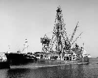 Glomar Challenger |
| Survey Equipment | Survey Info | Data Type(s) | Data Collected |
|---|---|---|---|
| magnetics | --- | Magnetics | |
| transitsatellite | --- | Navigation | |
| 12khz | --- | Single Beam | |
| 3.5khz | --- | Sub Bottom Profiler | |
| airgun | --- | Air Gun / Water Gun |
