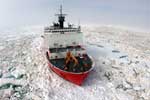
AKA: H0108AR
Other ID: H-1-08-AR, HLY0805, HLY0806
Status: Completed
Organization(s): USGS, Pacific Coastal and Marine Science Center
Funding Program(s): Other (Other), Law of the Sea - Outer Limits of the US continental Margins ()
Principal Investigator(s): Jonathan Childs
Affiliate Investigator(s):
Information Specialist(s): Jonathan Childs
Data Type(s): Environmental Data: Temperature, Location-Elevation: Navigation, Sampling: Geology, Sonar: Multibeam
Scientific Purpose/Goals: Mapping of the seafloor morphology in order to define the location of the 2500 meter contour and the foot of the continental slope as defined by the UN for Law of the Sea purposes.
Vehicle(s): None
Start Port/Location: Barrow, AK
End Port/Location: Barrow, AK
Start Date: 2008-08-14
End Date: 2008-09-05
Equipment Used: chaindredge, expendablebatthermograph, navigation, GPS, Seabeam
Information to be Derived: seismic
Summary of Activity and Data Gathered: added green logbook to holdings 2/28/18
Staff: Alex Andronikov, Andy Armstrong, Betsy Baker, Robert Bogucki, James Brinkley, Kelley Brumley, Dale Chayes, Pablo Clemente, Adriane Colburn, Larry Mayer
Affiliate Staff:
Brian Calder - CCOM UNH
Shachak Peeri - CCOM/IUNH
Monica Wolfson - CCOM UNH
Daiela Goncalves - CCOM/UNH
Koji Ito - CCOM/UNH
Priyantha Jindasa - CCOM/UNH
Neil Tinmouth - CCOM/UNH
Val Schmidt - CCOM/UNH
Rochelle Wigley - CCOM/UNH
Samual Greenaway - NOAA/CCOM
Ethan Roth - UCSD
Jimmy Jones Olemaun - Community Observer
Peter Legnos - US National Ice Center
William Walter - US National Ice Center
Walt Lincoln - US National Ice Center
Steve Roberts - UCAR/LDEO
Stephen Howard - ARMADA
David Skillicorn - NOAA
John Hall - CCOM
Marty Reedy - US Fish and Wildlife
Notes: USCGC Healy - HLY0805 http://www.icefloe.net/data/?cruise=HLY0805 NOAA Index to Marine & Lacustrine Geological Samples - HLY0805 http://www.ngdc.noaa.gov/geosamples/cruise.jsp?cru=HLY0805&shp=Healy
Staff information imported from InfoBank
Larry Mayer - CCOM UNH
Andy Armstrong - NOAA
Brian Calder - CCOM UNH
Shachak Peeri - CCOM/IUNH
Monica Wolfson - CCOM UNH
Robert Bogucki - CCOM UNH
Daiela Goncalves - CCOM/UNH
Koji Ito - CCOM/UNH
Priyantha Jindasa - CCOM/UNH
Neil Tinmouth - CCOM/UNH
Val Schmidt - CCOM/UNH
Rochelle Wigley - CCOM/UNH
Samual Greenaway - NOAA/CCOM
Kelley Brumley - UAF
Ethan Roth - UCSD
Betsy Baker - Vermont Law School
Adriane Colburn - Stanford University
Jimmy Jones Olemaun - Community Observer
James Brinkley - US National Ice Center
Peter Legnos - US National Ice Center
William Walter - US National Ice Center
Pablo Clemente (US National Ice Center) - Colon
Walt Lincoln - US National Ice Center
Dale Chayes - LDEO
Steve Roberts - UCAR/LDEO
Stephen Howard - ARMADA
Alex Andronikov - Univ of Mich
David Skillicorn - NOAA
John Hall - CCOM
Marty Reedy - US Fish and Wildlife
Location:
Chukchi Cap
| Boundaries | |||
|---|---|---|---|
| North: 83.1097 | South: 71.2949 | West: -167.999 | East: -139.13531 |
Platform(s):
 Healy |
Favela, J.J., Mizell, K., Gartman, A., and Hein, J.R., 2024, Geochemistry of ferromanganese crusts, nodules, and hydrothermally altered rocks from the Arctic Ocean: U.S. Geological Survey data release, https://doi.org/10.5066/P9E6IZIZ.
Favela, J.J., Mizell, K., Gartman, A., and Hein, J.R., 2024, Geochemistry of ferromanganese crusts, nodules, and hydrothermally altered rocks from the Arctic Ocean: U.S. Geological Survey data release, https://doi.org/10.5066/P9E6IZIZ.
Hein, J.R., Mizell, K., and Gartman, A., 2024, Neogene Hydrothermal Fe- and Mn-oxide Mineralization of Paleozoic Continental Rocks, Amerasia Basin, Arctic Ocean: Geochemistry, Geophysics, Geosystems, v. 25 no. 11, doi: 10.1029/2023GC010996.
| Survey Equipment | Survey Info | Data Type(s) | Data Collected |
|---|---|---|---|
| chaindredge | --- | Geology | Sample# HLY0805-DR3 Sample# HLY0805-DR7 Sample# HLY0805-DR5 IGSN# ECS000002 IGSN# ECS000001 Station Information Sample# HLY0805-DR1 IGSN# ECS000003 IGSN# ECS000004 IGSN# ECS000005 IGSN# ECS000006 IGSN# ECS000007 Sample# HLY0805-DR2 Sample# HLY0805-DR4 Sample# HLY0805-DR6 |
| expendablebatthermograph | --- | Temperature | |
| navigation | --- | Navigation | |
| GPS | --- | Navigation | Best file with nav in ArcInfo E00 format Global positioning system (GPS) data h-1-08-ar.060 (Provisional best file) |
| Seabeam | --- | Multibeam |