AKA: H-1-70-BS
Other ID: none
Status: Completed
Organization(s): Geological Survey of Canada
Funding Program(s):
Principal Investigator(s):
Affiliate Investigator(s):
Information Specialist(s):
Data Type(s): Electro-Magnetic: Gravity, Electro-Magnetic: Magnetics
Scientific Purpose/Goals:
Vehicle(s): None
Start Port/Location:
End Port/Location:
Start Date: 1970-08-17
End Date: 1970-08-23
Equipment Used: magnetometer, gravity
Information to be Derived:
Summary of Activity and Data Gathered: analog holdings
Staff:
Affiliate Staff:
Notes: FAN created on 11/20/2018 from InfoBank for analog holdings
Location:
Bering Sea, Alaska
| Boundaries | |||
|---|---|---|---|
| North: 65.87472467 | South: 50.17689812 | West: -173.32091735 | East: -141.68204643 |
Platform(s):
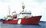 Hudson |
| Survey Equipment | Survey Info | Data Type(s) | Data Collected |
|---|---|---|---|
| magnetometer | --- | Magnetics | |
| gravity | --- | Gravity |
