AKA: H-1-70-NP
Other ID: none
Status: Completed
Organization(s): U.S. Naval Oceanographic Office
Funding Program(s):
Principal Investigator(s): Roland VonHuene
Affiliate Investigator(s):
Information Specialist(s): Vincent Bouchet
Data Type(s): Electro-Magnetic: Magnetics, Location-Elevation: Navigation, Seismics: Sparker, Sonar: Single Beam
Scientific Purpose/Goals:
Vehicle(s): None
Start Port/Location: Adak, Alaska
End Port/Location: Oakland, California
Start Date: 1970-06-10
End Date: 1970-06-12
Equipment Used: magnetometer, LoranC, transitsatellite, Sparker, sparker, 12khz
Information to be Derived:
Summary of Activity and Data Gathered:
Staff:
Affiliate Staff:
Notes: ! Converted to time format with year at start.
!
DATA COLLECTION OVERVIEW (use NGDC GEODAS CD to retrieve data)
MCG Data Collection ID --- H170NP
Institution Data Collection ID --- HU931005
NGDC ID --- 09040022
Funding --- NAVOCEANO
Project, Cruise & Leg --- LEG 1,2,3.
Study region --- +52.00000,+34.00000,+140.00000,-122.00000
Chief Scientist(s) --- NAVOCEANO CODE 3432
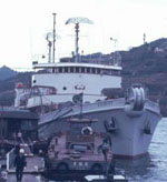
Name of vessel --- R/V HUNT (surface ship)
Date field data collection started --- 10/02/70 YOKOYAMA
Date field data collection ended --- 12/18/70 SAN FRANCISCO
Parameters surveyed ---
Bathymetry: surveyed, contained in data file
Magnetics: surveyed, contained in data file
Gravity: not surveyed
High-resolution seismics: surveyed, but not contained in data file
Deep penetration seismics: surveyed, but not contained in data file
Format ---
(I1,A8,F5.2,4I2,F5.3,F8.5,F9.5,I1,F6.4,F6.1,I2,i1,3F6.1,I1,F5.1,F6.0,F7.1,F6.1,F5.1,A8,4I1)
Date of data input to NGDC --- 10/15/79
Contributing institution --- US NAVAL OCEANOGRAPHIC OFFICE
Country --- USA
Navigation instrumentation --- MX-702 SATNAV,LORAN A/C
Position determination method --- (unspecified)
Bathymetry instrumentation --- 12 KHZ 45 DEG EDO TOWED XDUCER 1-SEC
SW
Additional forms of bathymetric data --- ANALOG, MICROFILM
General rate of bathymetry in file --- 5.0 minutes
General collection rate of bathymetry --- 1/SECOND
Assumed sound velocity --- 1430.0 m/sec
Bathymetric datum code --- No correction applied (sea level)
Bathmetry interpolation scheme --- SCALED 5- MIN VALUES COMPUTER
CONVERTED TO SONIC METERS
Magnetics instrumentation --- PROTON PRECESSION - VARAIN SYST
Additional forms of magnetics data --- ANALOG, MICROFILM
General rate of magnetics in file --- 5.1 minutes
General collection rate of magnetics --- (unspecified)
Magnetic sensor tow distance --- (unspecified)
Magnetic sensor depth --- (unspecified)
Two sensor horizontal separation --- (unspecified)
Residual magnetics reference field --- (unspecified)
Method of applying residual field --- (unspecified)
Seismic instrumentation --- TELEDYNE 30 KJ SPARKER, 4- SEC SWEEP
Formats of seismic data --- ANALOG , MICROFILM
Notes ---
3.5 KHZ PROFILES COLLECTED EDO 240 SYSTEM
IN PORT ADAK ADAK701022-701028,OAKLAND 701128-701204.
Location:
Northern Pacific
| Boundaries | |||
|---|---|---|---|
| North: 41.92843755 | South: 39.42843755 | West: -146.34293715 | East: -143.84293715 |
Platform(s):
 Hunt |
| Survey Equipment | Survey Info | Data Type(s) | Data Collected |
|---|---|---|---|
| magnetometer | --- | Magnetics | |
| LoranC | --- | Navigation | |
| transitsatellite | --- | Navigation | |
| Sparker | --- | Sparker | |
| sparker | --- | Sparker | |
| 12khz | --- | Single Beam |
