AKA: none
Other ID: H-1-96-HW
Status: Completed
Organization(s): USGS, Pacific Coastal and Marine Science Center
Funding Program(s): Hawaii Sand Resources (MU135)
Principal Investigator(s): Monty Hampton, Michael Torresan
Affiliate Investigator(s):
Information Specialist(s): Monty Hampton
Data Type(s): Seismics: Boomer, Location-Elevation: Navigation
Scientific Purpose/Goals: Map reef-front sediment deposits off Kailua Bay, Oahu.
Vehicle(s):
Start Port/Location: n/a
End Port/Location: n/a
Start Date: 1996-08-01
End Date: 1996-08-04
Equipment Used: Chirp, GPS
Information to be Derived: Location and thickness of reef-front sediment deposits.
Summary of Activity and Data Gathered: Ran survey lines at 0.5 to 1 km line spacing, typically perpendicular to the shoreline, from the reef edge to ~100 meter water depth in Kailua Bay.
Staff: Jim Barry
Affiliate Staff:
Marc Ericksen (Sea Engineering
Inc.
Technology Center) - Technician
Harvey Eli (Sea Engineering
Inc.) - Captain
Notes: Vessel from contractor Sea Engineering, Inc., Wiamamalo, HI.
Staff information imported from InfoBank
Monty Hampton (USGS Western Region) - Chief Scientist
Mike Torresan (Chief Scientist, USGS Western Region) - Co
Jim Barry (Sea Engineering, Inc., Technology Center) - Technician
Marc Ericksen (Sea Engineering, Inc., Technology Center) - Technician
Harvey Eli (Sea Engineering, Inc.) - Captain
Location:
Hawaii
| Boundaries | |||
|---|---|---|---|
| North: 21.45185 | South: 21.41093 | West: -157.7194 | East: -157.69355 |
Platform(s):
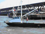 Huki Wana |
| Survey Equipment | Survey Info | Data Type(s) | Data Collected |
|---|---|---|---|
| Chirp | --- | Boomer | Survey information |
| GPS | --- | Navigation | Best file with nav in ArcInfo E00 format Global positioning system (GPS) data h-1-96-hw.060 (Provisional best file) |
