AKA: 2008-009-FA
Other ID: HLY0806, H-02-08-AR, H-2-08-AR
Status: Completed
Organization(s): USGS, Pacific Coastal and Marine Science Center
Funding Program(s): Law of the Sea - Outer Limits of the US continental Margins ()
Principal Investigator(s): Jonathan Childs
Affiliate Investigator(s): Debbie Hutchinson (USGS, Woods Hole)
Information Specialist(s): Jonathan Childs
Data Type(s): Electro-Magnetic: Gravity, Environmental Data: CTD, Sampling: Biology, Seismics: Sub Bottom Profiler, Sonar: Multibeam
Scientific Purpose/Goals: Collect bathymetry and gravity data as well as break ice for a second ship as part of delimiting the boundary of the U.S. extended continental shelf in the Eurasian Basin of the Arctic Ocean
Vehicle(s): None
Start Port/Location: Barrow, AK
End Port/Location: Barrow, AK
Start Date: 2008-09-05
End Date: 2008-10-01
Equipment Used: gravity, CTD, planktonnet, 512 chirp-source, Knudsen Chirp 3200, multibeam
Information to be Derived: Multibeam Bathymetry + Gravity (electronic, DVD)
Summary of Activity and Data Gathered: There were 5146 km of tracklines (multibeam + subbottom + gravity). Total area imaged was 39,311 km2 with the SeaBeam 2112. 11 stations were occupied for CTD and 10 stations for phytoplankton analysis.
Staff:
Affiliate Staff:
Notes: FAN renamed H208AR 10/18/2018
also exists as WH 2008-009-FA
FAN created for data on FAD 9/21/2017
Chirp system used;exact model not specified
Location:
Arctic Ocean
| Boundaries | |||
|---|---|---|---|
| North: 79.70986597 | South: 67.74998975 | West: -142.40078866 | East: -118.41641366 |
Platform(s):
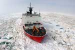 Healy |
| Survey Equipment | Survey Info | Data Type(s) | Data Collected |
|---|---|---|---|
| gravity | --- | Gravity | |
| CTD | --- | Surveys (geochemical) Experiments (geochemical) CTD | |
| planktonnet | --- | Biology | |
| 512 chirp-source | --- | Sub Bottom Profiler | |
| Knudsen Chirp 3200 | --- | Sub Bottom Profiler | |
| multibeam | --- | Multibeam |
