AKA: none
Other ID: 2012-038-FA, H-35-12-AR
Status: Completed
Organization(s): USGS, Pacific Coastal and Marine Science Center
Funding Program(s):
Principal Investigator(s): Katherine McMullen
Affiliate Investigator(s):
Information Specialist(s):
Data Type(s): Sampling: Geology
Scientific Purpose/Goals: To collect Arctic dredge samples if ice and available time allow.
Vehicle(s):
Start Port/Location: Barrow, AK
End Port/Location: Dutch Harbor, AK
Start Date: 2012-08-25
End Date: 2012-09-28
Equipment Used: dredge
Information to be Derived: Samples and chemical analysis; Rock dredge samples
Summary of Activity and Data Gathered: data on FAD
Staff:
Affiliate Staff:
Notes: updated FAN to H3512AR on 10/18/2018 (might be erroneous; H3812AR in InfoBank)
Personnel from InfoBank; Kate McMullen, Brian Buczkowski. FAN added 2017/07/13
Location:
Arctic, Greenland
| Boundaries | |||
|---|---|---|---|
| North: 81.52245584 | South: 76.52245584 | West: -38.78061295 | East: -33.78061295 |
Platform(s):
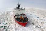 Healy |
| Survey Equipment | Survey Info | Data Type(s) | Data Collected |
|---|---|---|---|
| dredge | --- | Geology |
