AKA: 2012-038-FA
Other ID: HLY1202, H-38-12-AR
Status: Completed
Organization(s): USGS, Pacific Coastal and Marine Science Center, USGS, Woods Hole Coastal and Marine Science Center
Funding Program(s): Law of the Sea - Outer Limits of the US continental Margins ()
Principal Investigator(s):
Affiliate Investigator(s): Deborah Hutchinson, Larry Mayer (UNH), Lisa Robbins (USGS)
Information Specialist(s):
Data Type(s): Location-Elevation: Navigation, Sampling: Geology, Sonar: Single Beam
Scientific Purpose/Goals: To collect Arctic dredge samples if ice and available time allow.
Vehicle(s): None
Start Port/Location: Barrow, AK
End Port/Location: Dutch Harbor, AK
Start Date: 2012-08-25
End Date: 2012-09-28
Equipment Used: Differential GPS, dredge, grab, echosounder
Information to be Derived: Samples and chemical analysis;
Summary of Activity and Data Gathered: 2012 expedition into the Arctic for the U.S. Extended Continental Shelf project
Staff:
Affiliate Staff:
Notes: changed to H3812AR 10/18/2018
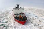
Cruise aboard USCG Healy is funded and led by NOAA/UNH. Healy operates its own dredge equipment. USGS is aboard to inventory samples for the ECS repository.
Project = LOS - New Data Acquisition,
Location:
Arctic Ocean
| Boundaries | |||
|---|---|---|---|
| North: 76.15084994 | South: 69.43478653 | West: -155.390625 | East: -126.8359375 |
Platform(s):
 Healy |
Favela, J.J., Mizell, K., Gartman, A., and Hein, J.R., 2024, Geochemistry of ferromanganese crusts, nodules, and hydrothermally altered rocks from the Arctic Ocean: U.S. Geological Survey data release, https://doi.org/10.5066/P9E6IZIZ.
Favela, J.J., Mizell, K., Gartman, A., and Hein, J.R., 2024, Geochemistry of ferromanganese crusts, nodules, and hydrothermally altered rocks from the Arctic Ocean: U.S. Geological Survey data release, https://doi.org/10.5066/P9E6IZIZ.
Hein, J.R., Mizell, K., and Gartman, A., 2024, Neogene Hydrothermal Fe- and Mn-oxide Mineralization of Paleozoic Continental Rocks, Amerasia Basin, Arctic Ocean: Geochemistry, Geophysics, Geosystems, v. 25 no. 11, doi: 10.1029/2023GC010996.
| Survey Equipment | Survey Info | Data Type(s) | Data Collected |
|---|---|---|---|
| Differential GPS | --- | Navigation | |
| dredge | --- | Geology | |
| grab | --- | Geology | |
| echosounder | --- | Single Beam |
