AKA: none
Other ID: H-3-97-HW
Status: Completed
Organization(s): Sea Engineering, Inc.
Funding Program(s):
Principal Investigator(s):
Affiliate Investigator(s): Marc Ericksen
Information Specialist(s): Jim Barry
Data Type(s): Seismics: Sub Bottom Profiler
Scientific Purpose/Goals: Map sub-bottom structure of Pearl Harbor Shelf
Vehicle(s):
Start Port/Location: Honolulu, Hawaii
End Port/Location: Honolulu, Hawaii
Start Date: 1997-09-15
End Date: 1997-09-16
Equipment Used: subbottomprofiler
Information to be Derived:
Summary of Activity and Data Gathered: Sea Engineering, Inc. (www.seaengineering.com)
Staff:
Affiliate Staff:
Notes:
Location:
Hawaii
| Boundaries | |||
|---|---|---|---|
| North: 26.75 | South: 15.25 | West: -163.75 | East: -151.25 |
Platform(s):
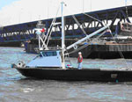 Huki Wana |
| Survey Equipment | Survey Info | Data Type(s) | Data Collected |
|---|---|---|---|
| subbottomprofiler | --- | Sub Bottom Profiler |
