AKA: none
Other ID: I-4-90-AT,AMASSEDS_CRUISE_II
Status: Completed
Organization(s): Louisiana Universities Marine Consortium, Woods Hole Oceanographic Institution, University of Washington, Bedford Institute of Oceanography, North Carolina State University, USGS, Pacific Coastal and Marine Science Center
Funding Program(s):
Principal Investigator(s):
Affiliate Investigator(s): Rocky Geyer (WHOI), John Maddock
Information Specialist(s):
Data Type(s): Environmental Data: CTD, Imagery: Photo, Sampling: Biology, Sampling: Geology, Environmental Data: Current, Time Series: Mooring (physical oceanography), Environmental Data: Turbidity
Scientific Purpose/Goals: To measure the physical, chemical and geological properties in the water column and seabed within the Amazon zone, that region extending from the mouth of the river across the shelf where there are strong gradients in salinity.
Vehicle(s):
Start Port/Location: Belem, Brazil
End Port/Location: Belem, Brazil
Start Date: 1990-03-09
End Date: 1990-03-21
Equipment Used: CTD, underwatercamera, boxcore, ADP, Geoprobe, turbiditymeter, currentmeter
Information to be Derived: CTD casts for suspended solids and analyzed for chemical species, pictures of flocculants within the water column, hourly profiles, samples, currents as a function of depth, temperature, salinity.
Summary of Activity and Data Gathered: Between the mouth of the Para River and anchor station 1, 5 CTD stations were occupied. Anchor station 1 was occupied between 1800 on 10 March and 1215 on 11 March. CTD casts were obtained once per hour, accompanied by 10 liter water samples at various depths. These samples were filtered for suspended solids and analyzed for chemical species. A plankton camera was attached to the CTD to take pictures ofthe flocculants within the water column. Hourly profiles were obtained with the Gafanhoto profiler. 8 box cores were obtained during the anchor station. A 600 kHz acoustic Doppler current profiler was operated continuously during the anchor stations and throughout the cruise, providing a continous record of that currents as a function of depth under the ship. During a portion of the anchor station a S4 electromagnetic current meter was deployed to measure currents, temperature and salinity. 9 CTD casts were conducted between anchor station 1 and the site of GEOPROBE. Attempts to recover GEOPROBE were abandoned because of rough weather. Anchor station 2 was occupied between 1700 on 12 March and 1900 on 13 March during which hourly CTD and gafanhoto casts were performed. Continous profiles with the S4 current meter were also performed. 2 box cores were also taken at the end of the station. After anchor station 2, the ship transited to mooring site M-2 to verify the moored equipment was intact then returned to site of GEOPROBE to attempt recovery. The recovery attempt was unsuccessful. Anchor statin 3 offshore of Rio Cunani was conducted between 0143 on 15 March to 0315 on 16 March. Anchor station 4, also offshore of Rio Cunani was occupied on 18 March at 1800 until 19 March at 1300. During this anchor station coastal sampling was conducted by UFPA and US scientists. The same set of measurements were made at stations 3 and 4 as at station 2. 7 CTD cast were obtained enroute to anchor station 5. Anchor station 5 was occupied at 1100 on 18 March to 1300 on 19 March. Same measurments were taken as at other anchor stations. A survey including 24 CTD casts extended from anchor station 5 to the 60 m isobath to anchor station 6. Anchor station 6 was performed at the river mouth, 12 m water depth, with same measurements taken as other anchor stations plus the addition of 6 box cores. Anchor station 7 reoccupied the site of anchor station 1. Between 0700 and 1930 on 21 March profile measurments and 6 box cores were obtained.
Staff: Greg Booth, Gail Kineke, George Tate, Mead Allison, Alfredo Bernedo, Paulo Cavalante, Cleise Cordeiro, Carlos Correa, Christopher Sherwood
Affiliate Staff:
John Maddock (chief Scientist) - Co
Brent McKee (Lumcon) - Scientist
Kim McCoy - Technician
Craig Marquette (WHOI) - Technician
Ellen Petticrew - Technician
Tim Milligan (Bedford Institute of Oceanography) - Technician
Pete Swarzenski (Lumcon) - Student
Tom Pacioni - Student
Steve Harden (North Carolina State University) - Student
Julio Faleiro - Student
Jose Neto - Student
Sven Muller - Student
Sergio Oliveira - Student
Marcelo Viana - Student
Marcelo Travassos - Student
Notes:
Staff information imported from InfoBank
Rocky Geyer (WHOI) - Chief Scientist
John Maddock (chief Scientist) - Co
Brent McKee (Lumcon) - Scientist
Kim McCoy - Technician
Craig Marquette (WHOI) - Technician
Chris Sherwood - Student
Ellen Petticrew - Technician
Tim Milligan (Bedford Institute of Oceanography) - Technician
Pete Swarzenski (Lumcon) - Student
Greg Booth - Student
Tom Pacioni - Student
Steve Harden (North Carolina State University) - Student
Gail Kineke (University Of Washington) - Student
George Tate (USGS) - Student
Mead Allison - Student
Alfredo Bernedo - Scientist
Paulo Cavalante - Student
Julio Faleiro - Student
Jose Neto - Student
Sven Muller - Student
Cleise Cordeiro - Student
Sergio Oliveira - Student
Carlos Correa - Technician
Marcelo Viana - Student
Marcelo Travassos - Student
Location:
Amazon Shelf
| Boundaries | |||
|---|---|---|---|
| North: 19.75 | South: -9.75 | West: -59.75 | East: -29.75 |
Platform(s):
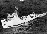 Columbus Iselin |
Rine, J.M. and N., Charles A., 1990, Report on field measurements and sampling during AmasSeds Cruise II - CI9002. Marine Sciences Research Center, State University of New York, NY. November 1990, 94 p.
| Survey Equipment | Survey Info | Data Type(s) | Data Collected |
|---|---|---|---|
| CTD | --- | Surveys (geochemical) Experiments (geochemical) CTD | |
| underwatercamera | --- | Video Photo | |
| boxcore | --- | Chemistry Biology Geology | |
| ADP | --- | Current | |
| Geoprobe | --- | Mooring (physical oceanography) | |
| turbiditymeter | --- | Turbidity | |
| currentmeter | --- | Current |
