AKA: none
Other ID: I-5-90-AT,AMASSEDS_CRUISE_II
Status: Completed
Organization(s): Woods Hole Oceanographic Institution, University of Washington, Universidade Federal Fluminense, Universidade Federal Do Para, Brazilian Geological Survey, USGS, Pacific Coastal and Marine Science Center
Funding Program(s):
Principal Investigator(s): Gail Kineke
Affiliate Investigator(s):
Information Specialist(s):
Data Type(s): Time Series: Mooring (physical oceanography)
Scientific Purpose/Goals: To recover the GEOPROBE.
Vehicle(s):
Start Port/Location: Belem, Brazil
End Port/Location: Belem, Brazil
Start Date: 1990-03-26
End Date: 1990-03-30
Equipment Used: Geoprobe
Information to be Derived:
Summary of Activity and Data Gathered: The recovery of the GEOPROBE was attempted without success from the vicinity of the M-2 mooring. The GEOPROBE is designed to be recovered by reeling in a cable attached to a float which is designed to rise to the surface when an acoustic release mechanism (100 kHz) attached to the GEOPROBE tripod is activated by a signal from the recovery ship. As during Leg 4, signal commands were sent to the acoustic release system without success but a responding signal from the GEOPROBE indicated the tripod was inplace and probably still operable. Recovery was then attempted by dragging the seabottom with grappling hooks. Recovery operations were suspended until Leg 1 of Cruise 3 (1 May - 8 May 1990).
Staff: George Tate, Joanne Thede
Affiliate Staff:
Enrico Pedroso (Federal University of Fluminense) - Undergraduate Student
Virginia Wanderley (Federal University of Fluminense) - Undergraduate Student
Claudio Reis (Federal University of Fluminense) - Undergraduate Student
Regina Guarany (Federal University of Fluminense) - Undergraduate Student
Paulo Lima (Brasilian Geological Survey) - Geologist
Henrique Lopes (Federal University of Para) - Undergraduate Student
Felipe Reis (Federal University of Para) - Undergraduate Student
Katia Cavalcante (Federal University of Fluminense) - Undergraduate Student
Richard Limeburner (WHOI) - Unspecified Investigator
Notes:
Staff information imported from InfoBank
Gail Kineke (University of Washington) - Chief Scientist
Enrico Pedroso (Federal University of Fluminense) - Undergraduate Student
Virginia Wanderley (Federal University of Fluminense) - Undergraduate Student
Claudio Reis (Federal University of Fluminense) - Undergraduate Student
Regina Guarany (Federal University of Fluminense) - Undergraduate Student
Paulo Lima (Brasilian Geological Survey) - Geologist
Henrique Lopes (Federal University of Para) - Undergraduate Student
Felipe Reis (Federal University of Para) - Undergraduate Student
Katia Cavalcante (Federal University of Fluminense) - Undergraduate Student
George Tate (USGS) - Unspecified Investigator
Joanne Ferreira (USGS) - Unspecified Investigator
Richard Limeburner (WHOI) - Unspecified Investigator
Location:
Amazon Shelf
| Boundaries | |||
|---|---|---|---|
| North: 19.75 | South: -9.75 | West: -59.75 | East: -29.75 |
Platform(s):
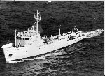 Columbus Iselin |
Rine, J.M. and N., Charles A., 1990, Report on field measurements and sampling during AmasSeds Cruise II - CI9002. Marine Sciences Research Center, State University of New York, NY. November 1990, 94 p.
| Survey Equipment | Survey Info | Data Type(s) | Data Collected |
|---|---|---|---|
| Geoprobe | --- | Mooring (physical oceanography) |
