AKA: none
Other ID: I-6-90-AT,AMASSEDS
Status: Completed
Organization(s): USGS, Pacific Coastal and Marine Science Center, State University of New York, Universidade Federal Fluminense
Funding Program(s):
Principal Investigator(s): Mead Allison
Affiliate Investigator(s): Gilberto Dias
Information Specialist(s):
Data Type(s): Time Series: Mooring (physical oceanography), Seismics: Sub Bottom Profiler
Scientific Purpose/Goals: To study the movement of sediment particles in the water column, the accumulation of sediment particles on the seabed, and the effects that sediment particles have on geochemical processes in the water column and seabed.
Vehicle(s):
Start Port/Location: Belem, Brazil
End Port/Location: Belem, Brazil
Start Date: 1990-05-01
End Date: 1990-05-07
Equipment Used: Geoprobe, seismic
Information to be Derived: High resolution seismic profiles
Summary of Activity and Data Gathered: Geophysical equipment was successfully tested and approximately 280 km of high resolution seismic profiles were obtained. The recovery of an instrumented-tripod (GEOPROBE) off the sea bottom was attempted but without success.
Staff: George Tate, Jim Nicholson, Joanne Thede, Christopher Sherwood
Affiliate Staff:
Geoffrey Pierson (MSRC
SUNY) - Student
Brien Perrodin (MSRC
SUNY) - Technician
Gilberto Dias (chief Scientist
UFF) - Co
Odete Silveira (UFPA) - Graduate Student
Newton Costa (UFPA) - Student
Nelson Carnerro (DHN) - Naval Observer
Notes:
Staff information imported from InfoBank
Mead Allison (MSRC, SUNY) - Chief Scientist
Geoffrey Pierson (MSRC, SUNY) - Student
George Tate (USGS) - Technician
Joanne Ferreira (USGS) - Technician
Jim Nicholson (USGS) - Technician
Chris Sherwood (USGS) - Technician
Brien Perrodin (MSRC, SUNY) - Technician
Gilberto Dias (chief Scientist, UFF) - Co
Odete Silveira (UFPA) - Graduate Student
Newton Costa (UFPA) - Student
Nelson Carnerro (DHN) - Naval Observer
Location:
Atlantic Ocean
| Boundaries | |||
|---|---|---|---|
| North: 19.75 | South: -9.75 | West: -59.75 | East: -29.75 |
Platform(s):
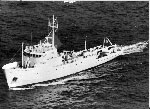 Columbus Iselin |
Rine, J.M. and N., Charles A., 1990, Report on field measurements and sampling during AmasSeds Cruise II - CI9004. Marine Sciences Research Center, State University of New York, NY. November 1990, 94 p.
| Survey Equipment | Survey Info | Data Type(s) | Data Collected |
|---|---|---|---|
| Geoprobe | --- | Mooring (physical oceanography) | |
| seismic | --- | Sub Bottom Profiler |
