AKA: none
Other ID: I-D2-09-MB,SCHARB
Status: Completed
Organization(s): USGS, Pacific Coastal and Marine Science Center
Funding Program(s): Santa Cruz Harbor Dredge Disposal Demonstration Project (MU254)
Principal Investigator(s): Curt Storlazzi
Affiliate Investigator(s):
Information Specialist(s): Joshua Logan
Data Type(s): Environmental Data: Conductivity, Environmental Data: Current, Environmental Data: Temperature, Environmental Data: Tide, Environmental Data: Turbidity, Environmental Data: Wave, Location-Elevation: Navigation
Scientific Purpose/Goals: Collect oceanographic data to understand influence of dredge disposal on nearshore ecosystems
Vehicle(s):
Start Port/Location: Santa Cruz Harbor
End Port/Location: Santa Cruz Harbor
Start Date: 2009-10-13
End Date: 2009-10-14
Equipment Used: wave/tide gauge, OBS, LISST, temperature/, salinity sensor, acousticdoppler, opticalbackscattersensor, GPS
Information to be Derived: current speed, current direction, acoustic backscatter, wave height, wave period, wave direction, tidal height, optical backscatter, sediment grain size, temperature, salinity
Summary of Activity and Data Gathered:
Staff: Peter Dal Ferro, Timothy Elfers, Kathy Presto, Kurt Rosenberger, Curt Storlazzi
Affiliate Staff:
Notes: doppler current profiler (ADCP) SCH_20m_Tripod and SCH_30m_Tripod were deployed on 10/21/2009. Recovery date 12/15/2009
Staff information imported from InfoBank
Curt Storlazzi (USGS, PSC) - chief scientist
Josh Logan (USGS, PSC) - information specialist
Kathy Presto (USGS, PSC) - instrumentation specialist
Kurt Rosenberger (USGS, PSC) - instrumentation specialist
Tim Elfers (USGS, PSC) - mechanical technician
Pete DalFerro (USGS, PSC) - mechanical technician
Location:
Monterey Bay
| Boundaries | |||
|---|---|---|---|
| North: 37 | South: 36.75 | West: -122.5 | East: -121.75 |
Platform(s):
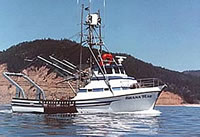 Shana Rae |
| Survey Equipment | Survey Info | Data Type(s) | Data Collected |
|---|---|---|---|
| wave/tide gauge | --- | Tide Wave | |
| OBS | --- | Sediment Properties Turbidity Biology Chemistry Geology | |
| LISST | --- | Turbidity | |
| temperature/ | --- | Temperature | |
| salinity sensor | --- | Conductivity | |
| acousticdoppler | --- | Current | Station Information |
| opticalbackscattersensor | --- | Turbidity | Station Information |
| GPS | --- | Navigation | Best file with nav in ArcInfo E00 format Global positioning system (GPS) data i-d2-09-mb.060 (Provisional best file) |
