AKA: none
Other ID: I-D3-10-SC,MCT01
Status: Completed
Organization(s): USGS, Pacific Coastal and Marine Science Center
Funding Program(s): California Urban Ocean (MU034)
Principal Investigator(s): Jingping Xu
Affiliate Investigator(s):
Information Specialist(s): Joanne Thede
Data Type(s): Environmental Data: Current, Environmental Data: Turbidity, Imagery: Photo, Location-Elevation: Navigation
Scientific Purpose/Goals: Investigate sediment transport and bypass of Mugu submarine canyon
Vehicle(s):
Start Port/Location: Ventura, CA
End Port/Location:
Start Date: 2010-04-27
End Date: 2010-05-01
Equipment Used: OBS3, Poking Eyeball Camera, GPS
Information to be Derived:
Summary of Activity and Data Gathered: Wave heights, periods, and directions, current speed and direction, sediment concentration & grainsize
Staff: Henry Chezar, Joanne Thede, Jingping Xu
Affiliate Staff:
Notes: Mugu Canyon Tracer Study. Instrument deployment MCT10NWT and MCT10SET
Staff information imported from InfoBank
Jingping Xu
Joanne Ferreira
Hank Chezar
Location:
California Coast near Port Hueneme
| Boundaries | |||
|---|---|---|---|
| North: 34.10889 | South: 34.09197 | West: -119.157 | East: -119.12411 |
Platform(s):
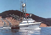 Shana Rae |
Kinsman, N., and Xu, J.P., 2012, Fluorescent tracer experiment on Holiday Beach near Mugu Canyon: U.S. Geological Survey Open-File Report 2012â1131, http://pubs.usgs.gov/of/2012/1131/.
| Survey Equipment | Survey Info | Data Type(s) | Data Collected |
|---|---|---|---|
| OBS3 | --- | Turbidity | Station Information |
| Poking Eyeball Camera | --- | Photo | |
| GPS | --- | Navigation | Best file with nav in ArcInfo E00 format Global positioning system (GPS) data i-d3-10-sc.060 (Provisional best file) |
