AKA: none
Other ID: I-D5-11-NC
Status: Completed
Organization(s): USGS, Pacific Coastal and Marine Science Center
Funding Program(s):
Principal Investigator(s): Patrick Barnard
Affiliate Investigator(s):
Information Specialist(s): Daniel Hoover
Data Type(s): Time Series: Mooring (physical oceanography)
Scientific Purpose/Goals: Characterize nearshore tides, currents, waves and turbidity
Vehicle(s):
Start Port/Location: Santa Cruz, CA
End Port/Location: Pillar Point Harbor
Start Date: 2011-05-02
End Date: 2011-05-02
Equipment Used: tripod
Information to be Derived: Tide, current, wave and turbidity time-series.
Summary of Activity and Data Gathered:
Staff: Jim Christmann, Joanne Thede, Daniel Hoover, Robert Wyland
Affiliate Staff:
Notes:
Staff information imported from InfoBank
Dan Hoover
Joanne Ferreira
Rob Wyland
Jim Christmann
Location:
CA
| Boundaries | |||
|---|---|---|---|
| North: 42.75 | South: 36.25 | West: -125.75 | East: -116.25 |
Platform(s):
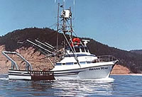 Shana Rae |
| Survey Equipment | Survey Info | Data Type(s) | Data Collected |
|---|---|---|---|
| tripod | --- | Mooring (physical oceanography) |
