AKA: none
Other ID: J-1-02-SC
Status: Completed
Organization(s): USGS, Pacific Coastal and Marine Science Center
Funding Program(s): National Seafloor Mapping and Benthic Habitat Studies (MU195)
Principal Investigator(s): Guy Cochrane
Affiliate Investigator(s):
Information Specialist(s): Guy Cochrane
Data Type(s): Location-Elevation: Navigation, Sonar: Sidescan
Scientific Purpose/Goals:
Vehicle(s):
Start Port/Location:
End Port/Location:
Start Date: 2002-07-11
End Date: 2002-07-18
Equipment Used: navigation, sidescansonar
Information to be Derived: Side scan images
Summary of Activity and Data Gathered:
Staff:
Affiliate Staff:
Notes: Associated cruises in southern California: B-1-98-SC B-1-99-SC B-2-99-SC M-1-99-SC M-1-00-SC J-1-02-SC M-1-02-SC M-1-03-SC S-5-04-SC
Staff information imported from InfoBank
Guy Cochrane (USGS Menlo Park) - Chief Scientist
Location:
Southern California
| Boundaries | |||
|---|---|---|---|
| North: 32.76462 | South: 32.61428 | West: -119.2467 | East: -117.23641 |
Platform(s):
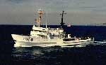 David Starr Jordan |
| Survey Equipment | Survey Info | Data Type(s) | Data Collected |
|---|---|---|---|
| navigation | --- | Navigation | Best file with nav in ArcInfo E00 format Eotvos/course/speed/distance data j-1-02-sc.070 Global positioning system (GPS) data j-1-02-sc.060 (Provisional best file) |
| sidescansonar | --- | Sidescan | File list |
