AKA: none
Other ID: K-03-13-BI
Status: Completed
Organization(s): University of Hawaii, National Park Service, University of California, Berkeley, USGS, Pacific Coastal and Marine Science Center
Funding Program(s): Coral Reefs (MU070)
Principal Investigator(s): Eric Grossman
Affiliate Investigator(s):
Information Specialist(s): Eric Grossman
Data Type(s): Environmental Data: CTD, Sampling: Chemistry
Scientific Purpose/Goals: Map submarine groundwater discharge and nearshore water properties affecting coral community composition, size structure, bleaching and health indicators.
Vehicle(s):
Start Port/Location: Kailua-Kona, HI
End Port/Location: Kailua-Kona, HI
Start Date: 2013-12-01
End Date: 2013-12-09
Equipment Used: CTD, samples
Information to be Derived: Nearshore water properties, circulation processes, groundwater flux and plume extent in nearshore
Summary of Activity and Data Gathered:
Staff: Eric Grossman
Affiliate Staff:
Lisa Marrack
Notes: kayaks, small skiffs used.
Staff information imported from InfoBank
Eric Grossman
Lisa Marrack
Non USGS data manager = Lisa Marrack
Location:
Hawaii
| Boundaries | |||
|---|---|---|---|
| North: 20.5 | South: 18.75 | West: -156.25 | East: -154.75 |
Platform(s):
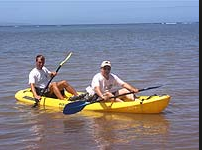 Kayak |
Grossman, E.G., and Marrack, L., 2019, Nearshore water properties and estuary conditions along the coral reef coastline of west Hawaii Island (2010-2014): U.S. Geological Survey data release.
| Survey Equipment | Survey Info | Data Type(s) | Data Collected |
|---|---|---|---|
| CTD | --- | Surveys (geochemical) Experiments (geochemical) CTD | |
| samples | --- | Biology Chemistry Geology |
