AKA: none
Other ID: K-04-11-MK
Status: Completed
Organization(s): USGS, Pacific Coastal and Marine Science Center, Partrac
Funding Program(s): Coral Reefs (MU070)
Principal Investigator(s): Dave Cacchione, Michael Field, Curt Storlazzi
Affiliate Investigator(s):
Information Specialist(s): Joshua Logan
Data Type(s): Location-Elevation: Navigation, Sampling: Geology, Time Series: Mooring (physical oceanography)
Scientific Purpose/Goals: track sediment transport.
Vehicle(s):
Start Port/Location: Kawela, Moloka`i
End Port/Location: Kawela, Moloka`i
Start Date: 2011-07-25
End Date: 2011-08-03
Equipment Used: navigation, samples, instrumentmooring
Information to be Derived: grain size and transport, tides, waves, wind, currents, turbidity, sediment dispersal rates, patterns
Summary of Activity and Data Gathered:
Staff:
Affiliate Staff:
Notes: small inflatable also used; land based pollution study of coral reef. Data exists on Makai/ots/Hawaii/Molokai
Location:
Moloka`i
| Boundaries | |||
|---|---|---|---|
| North: 21.0704 | South: 21.06464 | West: -156.971 | East: -156.95611 |
Platform(s):
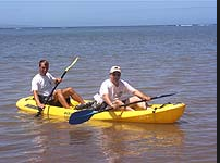 Kayak |
| Survey Equipment | Survey Info | Data Type(s) | Data Collected |
|---|---|---|---|
| navigation | --- | Navigation | Best file with nav in ArcInfo E00 format Lat/Long/UTM/State Plane data k-04-11-mk.650 (Provisional best file) |
| samples | --- | Biology Chemistry Geology | |
| instrumentmooring | --- | Geology Mooring (physical oceanography) |
