AKA: none
Other ID: K-4-73-SC,KEL473SC
Status: Completed
Organization(s):
Funding Program(s):
Principal Investigator(s): Gary Greene, Holly Wagner
Affiliate Investigator(s):
Information Specialist(s):
Data Type(s): Electro-Magnetic: Gravity, Electro-Magnetic: Magnetics, Location-Elevation: Navigation, Seismics: Boomer, Seismics: Sparker, Sonar: Sidescan, Sonar: Single Beam
Scientific Purpose/Goals: To obtain detailed geophysical data between Cape San Martin and Pt. Sal that would aid in identifying lithologic units and interpreting offshore geologic structure for the evaluation of potential hazards, if any, to large coastal installations and attendant offshore pipelines. Potential hazards may include such features as faults that cut the seafloor, areas of landsliding, and submarine slumping.
Vehicle(s):
Start Port/Location:
End Port/Location:
Start Date: 1973-11-08
End Date: 1973-11-18
Equipment Used: sparker, bathymetry, magnetics, sidescansonar, navigation, gravity, uniboom
Information to be Derived: Approximately 750 mi (1200 km) of deep penetration single channel seismic records were obtained using a 120,000 joule sub-bottom acoustic reflection profiling system with a 3-second sweep; hight resolution records were run simultaneously using an electrical-mechanical system with a 1/4 second sweep. Bathymetric data were obtained with a precision depth recorder, magnetic data were gathered with a ship-towed magnetometer, and side-scan sonar records wers taken locally. The track lines extended 6 to 10 mi from shore and were spaced one nautical mile apart throughout most of the area. Because of structural complications offshore from the Diablo Canyon site, another 80 mi (130 km) of geophysical line was run in that area December 1973, by Geomarine Services under contract to the Pacific Gas and Electric Company.
Summary of Activity and Data Gathered:
Staff: Steve Wolf
Affiliate Staff:
Notes: Staff information imported from InfoBank
Gary Greene (USGS Western Region) - Chief Scientist
Holly Wagner (USGS Western Region) - Chief Scientist
Steve Wolf (USGS Western Region) - Geologist
Location:
Central California
| Boundaries | |||
|---|---|---|---|
| North: 35.97465 | South: 32.3682 | West: -121.618 | East: -117.17274 |
Platform(s):
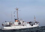 Kelez |
Arnal, R.E., and Vedder, J.G., 1976, Late Miocene paleobathymetry of California continental borderland north of 32 degrees: American Association of Petroleum Geologists Bulletin, v. 60 no. 12, pp. 1–8, URL: http://archives.datapages.com/data/pac_sepm/017/017001/pdfs/1.html.
Campbell, R.H., Wolf, S.C., Hunter, R.E., Wagner, H.C., Junger, A., and Vedder, J.G., 1975, Geologic map and sections, Santa Barbara Channel region, California: U.S. Geological Survey Open-File Report 75-0123, 1 p.
Steele, W.C., Degnan, C.H., Deeter, G.B., and Riordan, J.A., 1989, Description of marine geophysical data collected by the U.S. Geological Survey and how to obtain it: U.S. Geological Survey Open-File Report 89-167, 26 p., https://pubs.er.usgs.gov/publication/ofr89167.
Vedder, J.G., 1990, Maps of California continental borderland showing compositions and ages of bottom samples acquired between 1968 and 1979: U.S. Geological Survey Miscellaneous Field Studies Map 2122, 3 p., https://doi.org/10.3133/mf2122.
Vedder, J.G., and Howell, D.G., 1979, Geologic framework of the southern California borderland: U. S. Geological Survey Professional Paper 1150, pp. 146–147.
Vedder, J.G., Beyer, L.A., Junger, A., Moore, G.W., Roberts, A.E., Taylor, J.C., and Wagner, H.C., 1974, Preliminary report on the geology of the continental borderland of Southern California: U. S. Geological Survey Miscellaneous Field Studies Map 624, 34 p., https://doi.org/10.3133/mf624.
Vedder, J.G., Crouch, J.K., Scott, E.W., Greene, H.G., Cranmer, D., Ibrahim, M., Tudor, R.B., and Vinning, G., 1980, A summary report of the regional geology, petroleum potential, environmental geology, and operational considerations in the area of proposed lease sale no. 68, offshore southern California: U.S. Geological Survey Open-File Report 80-198, 64 p.
Vedder, J.G., Taylor, J.C., Arnal, R.E., and Bukry, D., 1976, Map showing location of selected pre-Quaternary rock samples from the California continental borderland: U. S. Geological Survey Miscellaneous Field Studies Map 737, https://doi.org/10.3133/mf737.
| Survey Equipment | Survey Info | Data Type(s) | Data Collected |
|---|---|---|---|
| sparker | --- | Sparker | |
| bathymetry | --- | Single Beam | |
| magnetics | --- | Magnetics | NGDC MGD77 data - Magnetics |
| sidescansonar | --- | Sidescan | |
| navigation | --- | Navigation | Dead reckoning data k-4-73-sc.010 (Provisional best file) Dead reckoning data k-4-73-sc.010_degree Best file with nav in ArcInfo E00 format Scan k-4-73-sc.small.tif Image k-4-73-sc.thumb.jpg Scan k-4-73-sc.full.tif |
| gravity | --- | Gravity | NGDC MGD77 data - gravity |
| uniboom | --- | Boomer |
