AKA: none
Other ID: K-5-73-SC
Status: Completed
Organization(s):
Funding Program(s): Southern California Continental Borderland (MU270)
Principal Investigator(s): George Moore
Affiliate Investigator(s):
Information Specialist(s):
Data Type(s): Electro-Magnetic: Gravity, Electro-Magnetic: Magnetics, Location-Elevation: Navigation, Seismics: Air Gun / Water Gun, Seismics: Boomer, Sonar: Single Beam
Scientific Purpose/Goals: Diablo Fault Survey
Vehicle(s):
Start Port/Location:
End Port/Location:
Start Date: 1973-11-23
End Date: 1973-12-10
Equipment Used: magnetics, airgunarcer, uniboom, bathymetry, gravity, navigation
Information to be Derived:
Summary of Activity and Data Gathered:
Staff: Larry Beyer, Nancy Byron, Vid Duda, Jim Nicholson, Byron Ruppel
Affiliate Staff:
Ken Pisciotto - Unspecified
Steve Sanders - Unspecified
Carolyn Norton - Unspecified
Dee Weaver - Unspecified
Leah Street - Unspecified
Notes:
Staff information imported from InfoBank
George Moore (USGS Western Region) - Chief Scientist
Larry Beyer (USGS Western Region) - Unspecified
Jim Nicholson (USGS Western Region) - Unspecified
Byron Ruppel (USGS Western Region) - Unspecified
Ken Pisciotto - Unspecified
Vid Duda - Unspecified
Steve Sanders - Unspecified
Carolyn Norton - Unspecified
Nancy Byron - Unspecified
Dee Weaver - Unspecified
Leah Street - Unspecified
Location:
California
| Boundaries | |||
|---|---|---|---|
| North: 33.60322 | South: 32.3682 | West: -120.034 | East: -117.17274 |
Platform(s):
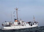 Kelez |
Arnal, R.E., and Vedder, J.G., 1976, Late Miocene paleobathymetry of California continental borderland north of 32 degrees: American Association of Petroleum Geologists Bulletin, v. 60 no. 12, pp. 1–8, URL: http://archives.datapages.com/data/pac_sepm/017/017001/pdfs/1.html.
Campbell, R.H., Wolf, S.C., Hunter, R.E., Wagner, H.C., Junger, A., and Vedder, J.G., 1975, Geologic map and sections, Santa Barbara Channel region, California: U.S. Geological Survey Open-File Report 75-0123, 1 p.
Vedder, J.G., 1990, Maps of California continental borderland showing compositions and ages of bottom samples acquired between 1968 and 1979: U.S. Geological Survey Miscellaneous Field Studies Map 2122, 3 p., https://doi.org/10.3133/mf2122.
Vedder, J.G., and Howell, D.G., 1979, Geologic framework of the southern California borderland: U. S. Geological Survey Professional Paper 1150, pp. 146–147.
Vedder, J.G., Beyer, L.A., Junger, A., Moore, G.W., Roberts, A.E., Taylor, J.C., and Wagner, H.C., 1974, Preliminary report on the geology of the continental borderland of Southern California: U. S. Geological Survey Miscellaneous Field Studies Map 624, 34 p., https://doi.org/10.3133/mf624.
Vedder, J.G., Crouch, J.K., Scott, E.W., Greene, H.G., Cranmer, D., Ibrahim, M., Tudor, R.B., and Vinning, G., 1980, A summary report of the regional geology, petroleum potential, environmental geology, and operational considerations in the area of proposed lease sale no. 68, offshore southern California: U.S. Geological Survey Open-File Report 80-198, 64 p.
Vedder, J.G., Taylor, J.C., Arnal, R.E., and Bukry, D., 1976, Map showing location of selected pre-Quaternary rock samples from the California continental borderland: U. S. Geological Survey Miscellaneous Field Studies Map 737, https://doi.org/10.3133/mf737.
| Survey Equipment | Survey Info | Data Type(s) | Data Collected |
|---|---|---|---|
| magnetics | --- | Magnetics | Raw gradiometer data k-5-73-sc.240_010 Edited gradiometer data k-5-73-sc.260_010 (Provisional best file) Raw gradiometer data k-5-73-sc.240 |
| airgunarcer | --- | Air Gun / Water Gun | |
| uniboom | --- | Boomer | |
| bathymetry | --- | Single Beam | |
| gravity | --- | Gravity | Free Air Anomaly data k-5-73-sc.161_010 (Provisional best file) Free Air Anomaly data k-5-73-sc.163 Free Air Anomaly data k-5-73-sc.161 |
| navigation | --- | Navigation | Best file with nav in ArcInfo E00 format Dead reckoning data k-5-73-sc.010_degree Dead reckoning data k-5-73-sc.010 (Provisional best file) |
