AKA: none
Other ID: L-09-11-GA,MGL1109
Status: Completed
Organization(s): USGS, Pacific Coastal and Marine Science Center, University of Wyoming, University of Texas
Funding Program(s): Law of the Sea - Outer Limits of the US continental Margins ()
Principal Investigator(s): Ginger Barth
Affiliate Investigator(s): Sean Gulick (UTexas, )
Information Specialist(s): Jonathan Childs
Data Type(s): Electro-Magnetic: Gravity, Environmental Data: Temperature, Location-Elevation: Navigation, Seismics: Multichannel, Seismics: Ocean Bottom Seismometer, Seismics: Sonobuoy, Sonar: Multibeam
Scientific Purpose/Goals: sediment thickness, velocity strucutre and sediment system architecture for Law of the Sea
Vehicle(s):
Start Port/Location: Kodiak, AK
End Port/Location: Kodiak, AK
Start Date: 2011-06-05
End Date: 2011-06-25
Equipment Used: gravity, temperature, Multichannel, bottomseismometer, Sonobuoy, GPS, multibeam
Information to be Derived:
Summary of Activity and Data Gathered:
Staff: Jonathan Childs, Ginger Barth, Peter Dal Ferro, Erik Everson, Patrick Hart, Ray Sliter, George Tate, Jennifer White
Affiliate Staff:
Sean Gulick - U Texas
Bobby Reese - U Texas
Maureen LeVoir - U Texas
Kevin Johnson - U Texas
Ryan Lester - U Texas
Notes: AKA MGL11-09 2011 Gulf of Alaska, U.S. Extended Continental Shelf Project, http://continentalshelf.gov/missions/11missions/11alaska.html
Staff information imported from InfoBank
Ginger Barth
Jon Childs
Pat Hart
Ray Sliter
Jenny White
Pete Dal Ferro
George Tate
Sean Gulick - U Texas
Bobby Reese - U Texas
Maureen LeVoir - U Texas
Kevin Johnson - U Texas
Ryan Lester - U Texas
Erik Everson - U Wyoming
Location:
Gulf of Alaska
| Boundaries | |||
|---|---|---|---|
| North: 57.1988 | South: 53.2795 | West: -152.126 | East: -138.249 |
Platform(s):
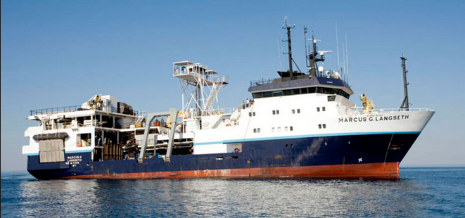 Marcus G. Langseth |
Barth, G.A., Baldwin, W.E., Reece, R.S., Gulick, S.S., Danforth, W.W., and Wong, F.L., 2022, Multibeam bathymetry and acoustic backscatter from the Alaskan region, Extended Continental Shelf Project, 2011 field season: Gulf of Alaska and Bering Sea: U.S. Geological Survey data release, https://doi.org/10.5066/F7HM56HK.
| Survey Equipment | Survey Info | Data Type(s) | Data Collected |
|---|---|---|---|
| gravity | --- | Gravity | |
| temperature | --- | Temperature | |
| Multichannel | --- | Multichannel | Seismic FFID/Shot/CDP data l-09-11-ga.410_mcs (Provisional best file) |
| bottomseismometer | --- | Ocean Bottom Seismometer | |
| Sonobuoy | --- | Sonobuoy | |
| GPS | --- | Navigation | Global positioning system (GPS) data l-09-11-ga.060 (Provisional best file) Best file with nav in ArcInfo E00 format |
| multibeam | --- | Multibeam |
