AKA: none
Other ID: L-1-73-AR
Status: Completed
Organization(s):
Funding Program(s):
Principal Investigator(s): Peter Barnes, Erk Reimnitz
Affiliate Investigator(s):
Information Specialist(s):
Data Type(s): Location-Elevation: Navigation, Seismics: Sparker, Sonar: Sidescan
Scientific Purpose/Goals:
Vehicle(s):
Start Port/Location:
End Port/Location:
Start Date: 1973-07-27
End Date: 1973-08-24
Equipment Used: navigation, sparker, sidescansonar
Information to be Derived:
Summary of Activity and Data Gathered:
Staff:
Affiliate Staff:
Notes: Staff information imported from InfoBank
Peter Barnes (USGS Western Region) - Chief Scientist
Erk Reimnitz (USGS Western Region) - Chief Scientist
Location:
Arctic Ocean
| Boundaries | |||
|---|---|---|---|
| North: 70.6 | South: 70.1 | West: -148 | East: -145.75 |
Platform(s):
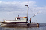 Loon |
Rearic, D.M., 1974, Ice Gouge Correlation Project: U. S. Geological Survey , https://walrus.wr.usgs.gov/infobank/k/k279ar/meta/IceGougeCorrelation.pdf.
| Survey Equipment | Survey Info | Data Type(s) | Data Collected |
|---|---|---|---|
| navigation | --- | Navigation | Best file with nav in ArcInfo E00 format Integrated navigation (SINS) data l-1-73-ar.050 (Provisional best file) |
| sparker | --- | Sparker | 011 012 08 21 1973 13 17 LINES 009 010 08 15 1973 13 00 LINE 002 08 21 1973 18 45 LINE 007 08 21 1973 22 40 LINES 007 008 08 22 1973 09 53 LINE 012 08 22 1973 16 30 LINE 014 08 23 1973 10 26 LINE 016 |
| sidescansonar | --- | Sidescan | 156346 LINE 001 156346 LINE 002 156346 LINE 003 156346 LINE 004 156346 LINE 005 197103 L173AR 197103 (Ice gouge log sheets) 156346 LINE 006 156346 LINE 007 156346 LINE 008 156346 LINE 009 156346 LINE 010 156346 LINE 011 156346 LINE 012 156346 LINE 013 156346 LINE 014 156346 LINE 016 156346 LINE 017 156346 LINE 018 156346 LINE 019 156346 LINE 015 |
