AKA: none
Other ID: L-1-83-WF,C-1-83-WF
Status: Completed
Organization(s):
Funding Program(s):
Principal Investigator(s): Bill Normark
Affiliate Investigator(s):
Information Specialist(s):
Data Type(s): Imagery: Photo, Imagery: Video, Location-Elevation: Navigation, Sampling: Geology, Seismics: Sub Bottom Profiler
Scientific Purpose/Goals:
Vehicle(s):
Start Port/Location: Esquimalt, B.C.
End Port/Location: Esquimalt, B.C.
Start Date: 1983-09-08
End Date: 1983-09-21
Equipment Used: 3.5khz, drillcore, underwatertelevision, underwatercamera, transitsatellite, LoranC, transponder
Information to be Derived:
Summary of Activity and Data Gathered:
Staff: Roger Cassivi, Henry Chezar, Harry Hill, Randy Koski, Jan Morton, Kevin O'Toole, Stephanie Ross, Pat Shanks, Andy Stevenson
Affiliate Staff:
Bill Lambie - Ship Captain
Bill Kehle - Chief Engineer
Paul Haley - Chief Mate
Jim Franklin - Geologist
Pat Ryall - Geologist
Fred Learning - Electronics Technician
Bill Whiteway - Mechanical Technician
George Fowler - Mechanical Technician
Notes:
Staff information imported from InfoBank
Bill Normark - Chief Scientist
Bill Lambie - Ship Captain
Bill Kehle - Chief Engineer
Paul Haley - Chief Mate
Jim Franklin - Geologist
Pat Ryall - Geologist
Randy Koski - Geologist
Andy Stevenson - Geologist
Pat Shanks - Geologist
Jan Morton - Geophysicist
Harry Hill - Electronics Technician
Fred Learning - Electronics Technician
Roger Cassivi - Electronics Technician
Kevin O'Toole - Mechanical Technician
Bill Whiteway - Mechanical Technician
George Fowler - Mechanical Technician
Stephanie Ross - Navigator
Hank Chezar - Unspecified Investigator
Location:
Juan de Fuca
| Boundaries | |||
|---|---|---|---|
| North: 48.6879 | South: 47.7372 | West: -125.151 | East: -122.4496 |
Platform(s):
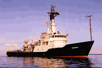 Paul Langevin III |
Chezar, H., and Newman, Ivy, 2004, DVD-Video Disc set of seafloor transects during USGS research cruises in the Pacific Ocean: U.S. Geological Survey Open-File Report 2004-1104.
Chezar, H., and Newman, Ivy, 2004, DVD-Video Disc set of seafloor transects during USGS research cruises in the Pacific Ocean: U.S. Geological Survey Open-File Report 2004-1105.
Chezar, H., and Newman, Ivy, 2004, DVD-Video Disc set of seafloor transects during USGS research cruises in the Pacific Ocean: U.S. Geological Survey Open-File Report 2004-1106.
Chezar, H., and Newman, Ivy, 2004, DVD-Video Disc set of seafloor transects during USGS research cruises in the Pacific Ocean: U.S. Geological Survey Open-File Report 2004-1107.
| Survey Equipment | Survey Info | Data Type(s) | Data Collected |
|---|---|---|---|
| 3.5khz | --- | Sub Bottom Profiler | Survey information |
| drillcore | --- | Geology | 14 22 15 17 18 19 21 25 27 Station Information |
| underwatertelevision | --- | Video | |
| underwatercamera | --- | Photo | |
| transitsatellite | --- | Navigation | Survey information |
| LoranC | --- | Navigation | |
| transponder | --- | Navigation |
