AKA: L0207MB
Other ID: L-2-07-MB
Status: Completed
Organization(s): USGS, Pacific Coastal and Marine Science Center
Funding Program(s): Monterey Canyon (MU184)
Principal Investigator(s): Jingping Xu
Affiliate Investigator(s):
Information Specialist(s): Kurt Rosenberger
Data Type(s): Environmental Data: Turbidity, Location-Elevation: Navigation, Sampling: Geology
Scientific Purpose/Goals: To measure turbidity currents in Monterey Submarine Canyon
Vehicle(s):
Start Port/Location: Moss Landing
End Port/Location: Moss Landing
Start Date: 2007-04-19
End Date: 2007-04-19
Equipment Used: turbiditymeter, GPS, samples
Information to be Derived: Current profiles in the bottom 70m of MSC
Summary of Activity and Data Gathered: Deploy one ADCP subsurface mooring (#835) in conjunction with MBARI at a location that will also have high resolution multibeam surveys.
Staff:
Affiliate Staff:
Notes:
Location:
Monterey Bay
| Boundaries | |||
|---|---|---|---|
| North: 37.29036 | South: 36.29036 | West: -122.327 | East: -121.32723 |
Platform(s):
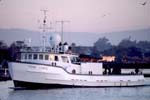 Point Lobos |
| Survey Equipment | Survey Info | Data Type(s) | Data Collected |
|---|---|---|---|
| turbiditymeter | --- | Turbidity | Station Information |
| GPS | --- | Navigation | Best file with nav in ArcInfo E00 format Global positioning system (GPS) data l-2-07-mb.060 (Provisional best file) |
| samples | --- | Biology Chemistry Geology |
