AKA: none
Other ID: L-2-72-AR
Status: Completed
Organization(s):
Funding Program(s):
Principal Investigator(s):
Affiliate Investigator(s):
Information Specialist(s):
Data Type(s): Location-Elevation: Navigation, Seismics: Sub Bottom Profiler, Sonar: Single Beam
Scientific Purpose/Goals:
Vehicle(s):
Start Port/Location:
End Port/Location:
Start Date: 1972-07-18
End Date: 1972-07-31
Equipment Used: navigation, subbottomprofiler, single beam sonar 180-280KHz
Information to be Derived:
Summary of Activity and Data Gathered:
Staff:
Affiliate Staff:
Notes:
Location:
Arctic Ocean
| Boundaries | |||
|---|---|---|---|
| North: 71 | South: 70 | West: -152 | East: -147.5 |
Platform(s):
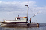 Loon |
Rearic, D.M., 1974, Ice Gouge Correlation Project: U. S. Geological Survey , https://walrus.wr.usgs.gov/infobank/k/k279ar/meta/IceGougeCorrelation.pdf.
| Survey Equipment | Survey Info | Data Type(s) | Data Collected |
|---|---|---|---|
| navigation | --- | Navigation | |
| subbottomprofiler | --- | Sub Bottom Profiler | |
| single beam sonar 180-280KHz | --- | Single Beam | Log book 2 Log book 3 Log book |
