AKA: none
Other ID: M-08-89-PR,MW8908
Status: Completed
Organization(s):
Funding Program(s):
Principal Investigator(s):
Affiliate Investigator(s): Nancy Breen
Information Specialist(s):
Data Type(s): Location-Elevation: Navigation, Sonar: Sidescan
Scientific Purpose/Goals:
Vehicle(s):
Start Port/Location: Jacksonville, FL
End Port/Location: San Juan, Puerto Rico
Start Date: 1989-06-19
End Date: 1989-07-21
Equipment Used: navigation, side scan sonar
Information to be Derived:
Summary of Activity and Data Gathered:
Staff:
Affiliate Staff:
Notes: paper logsheets Surey Indetifier: MW8908
Location:
Bahamas-Antilles collision zone
| Boundaries | |||
|---|---|---|---|
| North: 20.75 | South: 15.25 | West: -68.75 | East: -63.25 |
Platform(s):
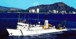 Moana Wave |
| Survey Equipment | Survey Info | Data Type(s) | Data Collected |
|---|---|---|---|
| navigation | --- | Navigation | |
| side scan sonar | --- | Sidescan |
