AKA: none
Other ID: M-1-01-GM
Status: Completed
Organization(s): University of New Brunswick, USGS, Biological Resources Division, Gainesville, USGS, Pacific Coastal and Marine Science Center, University of New Hampshire
Funding Program(s):
Principal Investigator(s): Jim Gardner
Affiliate Investigator(s):
Information Specialist(s):
Data Type(s): Location-Elevation: Navigation, Sonar: Multibeam, Sonar: Sidescan
Scientific Purpose/Goals: multibeam mapping between 50 and 150 meter isobaths south from eastern edge of De Soto Canyon to Steamboat Lumps
Vehicle(s):
Start Port/Location: Panama City, FL
End Port/Location: Panama City, FL
Start Date: 2001-09-03
End Date: 2001-10-11
Equipment Used: GPS, sidescansonar, multibeam
Information to be Derived:
Summary of Activity and Data Gathered:
Staff: Peter Dartnell, Dave Everhart, David Fitts, Jim Gardner, Larry Mayer
Affiliate Staff:
Brian Calder - Sept 3 to Sept. 17
John Hughes - Sept 3 to Sept. 17
Anya Duxfield - Sept 3 to Sept. 17
Mark Paton - Sept 3 to Sept. 17
Michael Annis - Sept. 3 to Sept. 4
Garret Duffy - Sept. 17 to Oct. 11
Art Kleiner - Sept 3 to Sept. 17
Ryan Larson - Sept 3 to Sept. 17
Wes Kitt - Sept 3 to Oct. 11
Eric Ortego - Sept 3 to Oct. 11
Heather Carnocki - Sept 3 to Oct. 11
Notes: For raw and intermediate data sets, contact Rani Nandiwada
Staff information imported from InfoBank
Jim Gardner - Sept 3 to Oct. 11
Pete Dartnell - Sept 3 to Oct. 11
Larry Mayer - Sept 3 to Sept 17
Brian Calder - Sept 3 to Sept. 17
John Hughes - Sept 3 to Sept. 17
Anya Duxfield - Sept 3 to Sept. 17
Mark Paton - Sept 3 to Sept. 17
Michael Annis - Sept. 3 to Sept. 4
Garret Duffy - Sept. 17 to Oct. 11
Art Kleiner - Sept 3 to Sept. 17
David Fitts - Sept. 17 to Oct. 11
Ryan Larson - Sept 3 to Sept. 17
Wes Kitt - Sept 3 to Oct. 11
Eric Ortego - Sept 3 to Oct. 11
Heather Carnocki - Sept 3 to Oct. 11
Dave Everhart - Capt.
Location:
Northeastern Gulf of Mexico
| Boundaries | |||
|---|---|---|---|
| North: 30.06667 | South: 28.03333 | West: -86.7167 | East: -84.61666 |
Platform(s):
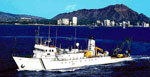 Moana Wave |
Gardner, J., Mayer, L.A., Hughes-Clarke, J.E., Dartnell, P., and Sulak, K.J., 2001, R/V Moana Wave Cruise M1-01-GMâThe Bathymetry and Acoustic Backscatter of the Mid Shelf to Upper Slope off Panama City, Florida, Northeastern Gulf of Mexico, September 3, through October 12, 2001 Panama City, FL to Panama City, FL: U.S. Geological Survey Open-File Report 01-448, https://doi.org/10.3133/ofr01448.
| Survey Equipment | Survey Info | Data Type(s) | Data Collected |
|---|---|---|---|
| GPS | --- | Navigation | |
| sidescansonar | --- | Sidescan | |
| multibeam | --- | Multibeam | File list |
