AKA: none
Other ID: M-1-71-NC
Status: Completed
Organization(s):
Funding Program(s): Continental Shelf Bottom Gravity Survey (MU066)
Principal Investigator(s):
Affiliate Investigator(s): N.A. Prahl,G.B. Mills
Information Specialist(s):
Data Type(s): Electro-Magnetic: Gravity, Location-Elevation: Navigation, Sonar: Single Beam
Scientific Purpose/Goals:
Vehicle(s):
Start Port/Location:
End Port/Location:
Start Date: 1971-04-12
End Date: 1971-12-07
Equipment Used: navigation, bathymetry, gravity
Information to be Derived: Gravity range, gravity range contour maps, gravity range bathymetry
Summary of Activity and Data Gathered: 313 bottom gravity measurements were made over a 200 square nautical mile area on the Continental Shelf approximately 20 miles due west of Cape Flattery, WA. Observations were made at one nautical mile intervals to establish a test range for evaluating the accuracy and performance of underway sea-surface gravimeters. In addition, 499 bottom gravity measurements were made on the Continental Shelf between the 5 and 100 fathom isobaths from Cape Flattery, WA, to Monterey Bay, ca. Measurements were made at 5 mile intervals as part of the National Ocean Surveys marine gravity program. 32 sea-fix shore stations were established. The shore station pairing for the gravity test range included EPI Mukkaw (north station) and Quill RMS (south station).
Staff:
Affiliate Staff:
Notes: Information from Prahl, N.A., and Mills, G.B. operational data report west coast continental shelf bottom gravity Cape Flattery to Santa Cruz National Oceanic and Atmospheric Administration (NOAA) ship McArthur 1971: Dept. of Commerce, NOAA, NOS, Marine Geophysics Group, 32 p.
Staff information imported from InfoBank
N.A. Prahl - Chief Scientist
G.B. Mills - Chief Scientist
Location:
Northern California
| Boundaries | |||
|---|---|---|---|
| North: 43 | South: 36.25 | West: -125.75 | East: -121.75 |
Platform(s):
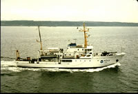 McArthur |
| Survey Equipment | Survey Info | Data Type(s) | Data Collected |
|---|---|---|---|
| navigation | --- | Navigation | |
| bathymetry | --- | Single Beam | |
| gravity | --- | Gravity |
