AKA: none
Other ID: M-1-76-WO,MIL1-76-WO
Status: Completed
Organization(s): USGS, Pacific Coastal and Marine Science Center
Funding Program(s): Geological Environmental Hazards (MU115)
Principal Investigator(s): Howard Gower, Parke Snavely
Affiliate Investigator(s):
Information Specialist(s):
Data Type(s): Seismics: Boomer, Seismics: Sparker, Location-Elevation: Navigation, Location-Elevation: Transects
Scientific Purpose/Goals: To provide information on the thickness and distribution of Quaternary deposits to identify structures that deform them and to provide a basis for assessing geological environmental hazards.
Vehicle(s):
Start Port/Location: Seattle, WA - Ballard and Penn Cove and Chuckanut Bay and Anacortes and Port Townsend and Keystone and Port Gamble and Quilcene Bay and Keyport
End Port/Location: Penn Cove and Chuckanut Bay and Anacortes and Port Townsend and Keystone and Port Gamble and Quilcene Bay and Keyport and Seattle, WA - Ballard
Start Date: 1976-01-12
End Date: 1976-01-20
Equipment Used: uniboom, minisparker, radar, bottomtransponder
Information to be Derived: Seismic reflection profiles.
Summary of Activity and Data Gathered: High resolution profiling along 425 km of track in northern Puget Sound.
Staff: Bill Clique, Dick Tagg, Jack Lee, Robert Stacey
Affiliate Staff:
Bob Ramstad (Aboard) - Watchstander
Don Tiffin - Geologist
Ed Magalhaes - Chief Engineer
Jim Pearl - Dafe Curator
Jim Yount - Geologist
Notes:
Staff information imported from InfoBank
Bill Clique - Chief Mate
Bob Ramstad (Aboard) - Watchstander
Dick Tagg - Geologist
Don Tiffin - Geologist
Ed Magalhaes - Chief Engineer
Howard Gower - Chief Scientist
Jack Lee - Electronics Technician
Jim Pearl - Dafe Curator
Jim Yount - Geologist
Parke Snavely - Chief Scientist
Robert Stacey - Ship Captain
Location:
Washington
| Boundaries | |||
|---|---|---|---|
| North: 48.5 | South: 47 | West: -123 | East: -122 |
Platform(s):
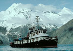 Don J. Miller II |
Snavely, P.D., Jr., Gower, H.D., Tagg, A.R., Lander, D.L., and Novak, R.L., 1978, High-resolution seismic profiles in southern Strait of Georgia, Washington: U.S. Geological Survey Open-File Report 78-1061, 1 p.
Snavely, P.D., Jr., Gower, H.D., Yount, J.C., Pearl, J.E., Tagg, A.R., Lee, J.W., and Lander, D.L., 1978, Notes on acquisition of high-resolution seismic profiles in southern Puget Sound, Washington: U.S. Geological Survey Open-File Report 78-328, 1 p.
Snavely, P.D., Jr., Gower, H.D., Yount, J.C., Tagg, R.A., Lee, J.W., and Lander, D.L., 1977, High resolution seismic profiles in Hood Canal and southern Puget Sound, Washington: U.S. Geological Survey Open-File Report 77-0195, 1 p.
Snavely, P.D., Jr., Gower, H.D., Yount, J.C., Pearl, J.E., Tagg, A.R., and Lee, J.W., 1976, High resolution seismic profiles adjacent to Whidbey and Fidalgo islands, Washington: U.S. Geological Survey Open-File Report 76-187, 1 p.
| Survey Equipment | Survey Info | Data Type(s) | Data Collected |
|---|---|---|---|
| uniboom | --- | Boomer | Survey information |
| minisparker | --- | Sparker | Survey information |
| radar | --- | Navigation | Lines |
| bottomtransponder | --- | Transects |
