AKA: none
Other ID: M-1-78-WO
Status: Completed
Organization(s): USGS, Pacific Coastal and Marine Science Center
Funding Program(s):
Principal Investigator(s): Parke Snavely
Affiliate Investigator(s):
Information Specialist(s):
Data Type(s): Location-Elevation: Navigation, Seismics: Air Gun / Water Gun, Seismics: Boomer
Scientific Purpose/Goals: To provide information on the thickness and distribution of Quaternary deposits, to identify folds and faults that deform them, and to provide a basis for assessing geoenvironmental hazards.
Vehicle(s):
Start Port/Location:
End Port/Location:
Start Date: 1978-01-17
End Date: 1978-01-23
Equipment Used: airgun, uniboom, radar
Information to be Derived: Seismic reflection profiles.
Summary of Activity and Data Gathered: Approximately 48 km of high-resolution seismic reflection profiles were obtained in the Strait of Georgia, Washington, from January 22 to 23, 1978. Tracklines were located by ships radar with variable range marker. The source of seismic energy used was a 400-600 Joule double-back Uniboom system with a recorder sweep rate of 1/4-second and a 1/4- or 1/2-second firing rate. Filter settings for the lines generally were 2900 Hz (high) and 850 Hz (low). Ships average speed was about 5 knots.
Staff: Howard Gower, Diane Lander, Bob Novak, Dick Tagg
Affiliate Staff:
R.L. Robeck - Ship Captain
Notes:
Staff information imported from InfoBank
Parke Snavely (USGS Western Region) - Chief Scientist
Howard Gower (USGS Western Region) - Investigator
Dick Tagg (USGS Western Region) - Investigator
Diane Lander (USGS Western Region) - Investigator
R.J. Novak (USGS Western Region) - Investigator
R.L. Robeck - Ship Captain
Location:
Washington
| Boundaries | |||
|---|---|---|---|
| North: 50 | South: 41 | West: -131.25 | East: -122.25 |
Platform(s):
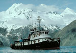 Don J. Miller II |
| Survey Equipment | Survey Info | Data Type(s) | Data Collected |
|---|---|---|---|
| airgun | --- | Air Gun / Water Gun | |
| uniboom | --- | Boomer | |
| radar | --- | Navigation |
