AKA: none
Other ID: M-1-91-NC
Status: Completed
Organization(s): National Oceanic and Atmospheric Administration
Funding Program(s):
Principal Investigator(s):
Affiliate Investigator(s): Cheryl Callahan (NMFS)/Oceanographer
Information Specialist(s):
Data Type(s): Sampling: Geology
Scientific Purpose/Goals: To establish two reference areas in which no dumping has taken place with three primary goals: 1. Develop and test traps for sampling benthic fish and shellfish, 2. Evaluate the ability to sample potential target species, 3. Obtain specimens from reference stations to provide a baseline of contaminants and radionuclides from clean areas for later comparison with possibly contamintated areas.
Vehicle(s):
Start Port/Location:
End Port/Location:
Start Date: 1991-11-09
End Date: 1991-11-20
Equipment Used: VanVeengrab, Soutargrab
Information to be Derived: Sediment size, biological and sediment collection data, radionuclide analysis, trace metals and organics analysis
Summary of Activity and Data Gathered:
Staff: Norman Maher
Affiliate Staff:
Tom Jow (GFNMS) - Marine Biologist
Donald MacDonald (Hazmat) - Oceanographer
Jan Roletto (GFNMS) - Research Coordinator
Joan Walsh (PRBO) - Biologist
Notes:
Staff information imported from InfoBank
Cheryl Callahan (NMFS) - Chief Scientist/Oceanographer
Tom Jow (GFNMS) - Marine Biologist
Norman Maher (USGS) - Geologist
Donald MacDonald (Hazmat) - Oceanographer
Jan Roletto (GFNMS) - Research Coordinator
Joan Walsh (PRBO) - Biologist
Location:
Gulf of Farallon Islands
| Boundaries | |||
|---|---|---|---|
| North: 38.25 | South: 36.25 | West: -123.75 | East: -121.75 |
Platform(s):
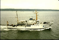 McArthur |
| Survey Equipment | Survey Info | Data Type(s) | Data Collected |
|---|---|---|---|
| VanVeengrab | --- | Geology | |
| Soutargrab | --- | Geology |
