AKA: none
Other ID: M-1-92-PW
Status: Completed
Organization(s):
Funding Program(s):
Principal Investigator(s):
Affiliate Investigator(s): Bill Gronlund
Information Specialist(s):
Data Type(s): Sampling: Geology
Scientific Purpose/Goals:
Vehicle(s):
Start Port/Location:
End Port/Location:
Start Date: 1992-05-27
End Date: 1992-06-04
Equipment Used: Smith-MacIntyregrab
Information to be Derived:
Summary of Activity and Data Gathered:
Staff: Paul Carlson, Keith Kvenvolden
Affiliate Staff:
Larry Simoneaux - Captain
Bill Sites - Lt.
John Herring - Lt.
Kendra Swanson - driver
Miller ?
Sabrina ?
Kurt ?
Notes:
Staff information imported from InfoBank
Bill Gronlund - Chief Scientist
Paul Carlson - USGS Western Region
Keith Kvenvolden
Larry Simoneaux - Captain
Bill Sites - Lt.
John Herring - Lt.
Kendra Swanson - driver
Miller ?
Sabrina ?
Kurt ?
Location:
Alaska
| Boundaries | |||
|---|---|---|---|
| North: 61.5 | South: 59.5 | West: -149.5 | East: -145 |
Platform(s):
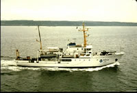 McArthur |
| Survey Equipment | Survey Info | Data Type(s) | Data Collected |
|---|---|---|---|
| Smith-MacIntyregrab | --- | Geology |
