AKA: none
Other ID: M-1-93-MB
Status: Completed
Organization(s):
Funding Program(s):
Principal Investigator(s): Gary Greene, Andy Stevenson
Affiliate Investigator(s):
Information Specialist(s):
Data Type(s): Location-Elevation: Navigation, Seismics: Boomer, Sonar: Sidescan
Scientific Purpose/Goals:
Vehicle(s):
Start Port/Location:
End Port/Location:
Start Date: 1993-06-01
End Date: 1993-06-14
Equipment Used: GPS, sidescansonar, mudshark
Information to be Derived:
Summary of Activity and Data Gathered:
Staff: Michael Boyle, Steve Eittreim, John Gann, Larry Kooker, Dennis Mann
Affiliate Staff:
Notes: physical data holdings
Associated activities: M-1-93-MB J-1-94-MB J-2-95-MB J-6-95-MB M-2-95-MB P-1-95-MB P-3-95-MB R-1-95-MB M-1-96-MB J-1-97-MB J-3-97-MB A-4-98-MB J-3-98-MB J-4-98-MB
Staff information imported from InfoBank
Andy Stevenson - Chief Scientist
Gary Greene - Chief Scientist
Steve Eittreim - Watchstander
Dennis Mann - Geophysicist/seismic Watchstander
John Gann - Navigator
Larry Kooker - Electronics Technician
Mike Boyle - Electronics Technician
Location:
Monterey Bay
| Boundaries | |||
|---|---|---|---|
| North: 37.50198 | South: 36.61548 | West: -122.5054 | East: -121.78513 |
Platform(s):
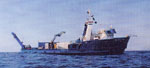 William A. McGaw |
Green, H.G., Orange, D., Mann, D., and Gabel, G., 1994, Fluid constructed morphology on Smooth Ridge, Central California: American Geophysical Union Eos, Transactions, v. 75 no. 44, pp. 598–598.
Mann, D.M., Greene, H.G., and Robison, B.H., 1992, Fault deformation of the Monterey Bay region, California: American Geophysical Union Eos, Transactions, v. 73 no. 43, pp. 318–318.
| Survey Equipment | Survey Info | Data Type(s) | Data Collected |
|---|---|---|---|
| GPS | --- | Navigation | Best file with nav in ArcInfo E00 format Integrated navigation (SINS) data m-1-93-mb.051 (Provisional best file) Integrated navigation (SINS) data m-1-93-mb.051_degree |
| sidescansonar | --- | Sidescan | File list sidescan (data on FAD) |
| mudshark | --- | Boomer |
