AKA: none
Other ID: M-1-98-GM
Status: Completed
Organization(s): USGS, Pacific Coastal and Marine Science Center, University of Mississippi
Funding Program(s): Gulf of Mexico Tectonics and Hydrates Project (MU132)
Principal Investigator(s): Alan Cooper
Affiliate Investigator(s): Thomas McGee (Univ Miss)
Information Specialist(s): Alan Cooper, Patrick Hart
Data Type(s): Seismics: Boomer, Seismics: Air Gun / Water Gun, Seismics: Ocean Bottom Seismometer, Location-Elevation: Navigation, Seismics: Multichannel
Scientific Purpose/Goals: Gas hydrate study
Vehicle(s):
Start Port/Location: Biloxi, MS
End Port/Location: Biloxi, MS
Start Date: 1998-06-08
End Date: 1998-06-20
Equipment Used: Huntec, watergun, bottomseismometer, generatorinjectorgun, YoNav, 24channel
Information to be Derived: Geometry, structure, and stratigraphy of the hydrate zone; Reflection coefficients and estimates of physical properties of the sedimentary section.
Summary of Activity and Data Gathered: Detailed seismic investigation of the gas hydrate stability zone in the Gulf of America (Gulf of Mexico), using a wide range of very-high frequency seismic data sampled at very high rates (16 Khz to 200 Khz)
Staff: Hal Williams, Walt Olson, Larry Kooker, Fred Payne, Patrick Hart, Ingo Pecher
Affiliate Staff:
Jim Petermann - Electronics Technician
Mike Belliveau - Electronics Technician
Robert Luliiucci - Electronics Technician
Kathy Grace - Watchstander
Notes: The R/V Tommy Munro is owned and operated by the Univ. of Southern Mississippi Institute of Marine Sciences. The ship operates out of Biloxi, Mississippi. The cruise was a cooperative venture between the USGS and the Univ. of Mississippi (McGee), USGS-MMRI cruise.
Staff information imported from InfoBank
Alan Cooper - Chief Scientist
Thomas McGee (Univ Miss) - Chief Scientist
Hal Williams - Mechanical Technician
Walt Olson - Mechanical Technician
Jim Petermann - Electronics Technician
Larry Kooker - Electronics Technician
Fred Payne - Electronics Technician
Mike Belliveau - Electronics Technician
Robert Luliiucci - Electronics Technician
Pat Hart - Geophysicist
Ingo Pecher - Geophysicist
Kathy Grace - Watchstander
Paul - Captain
Greg - Chief Mate
Location:
Gulf of America (Gulf of Mexico) - Mississippi Canyon
| Boundaries | |||
|---|---|---|---|
| North: 30.39364 | South: 28.01967 | West: -89.9565 | East: -88.77296 |
Platform(s):
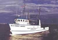 Tommy Munro |
Cooper, A.K., Hart, P.E., Pecher, I., 1998, Cruise report for a seismic investigation of gas hydrates in the Mississippi Canyon region, northern Gulf of Mexico; cruise M1-98-GM: U.S. Geological Survey Open-File Report 98-506, http://pubs.er.usgs.gov/publication/ofr98506.
| Survey Equipment | Survey Info | Data Type(s) | Data Collected |
|---|---|---|---|
| Huntec | --- | Boomer | Survey information |
| watergun | --- | Air Gun / Water Gun | Survey information |
| bottomseismometer | --- | Ocean Bottom Seismometer | Station Information |
| generatorinjectorgun | --- | Air Gun / Water Gun | |
| YoNav | --- | Navigation | Best file with nav in ArcInfo E00 format Global positioning system (GPS) data m-1-98-gm.062 (Provisional best file) Global positioning system (GPS) data m-1-98-gm.062_degree Lines green logbook (data in holdings) |
| 24channel | --- | Multichannel | Seismic FFID/Shot/CDP data m-1-98-gm.410 Edited seismic shot point data m-1-98-gm.420 Edited seismic shot point data m-1-98-gm.420_062 (Provisional best file) Survey information seismic data rolls (data in holdings) |
