AKA: none
Other ID: M-1-98-MB,M-1-98-NC
Status: Completed
Organization(s):
Funding Program(s): Monterey Bay National Marine Sanctuary (MU182)
Principal Investigator(s): Roberto Anima, Brian Edwards, Steve Eittreim
Affiliate Investigator(s):
Information Specialist(s): Jamie Stocking
Data Type(s): Imagery: Photo, Imagery: Video, Location-Elevation: Navigation, Sampling: Geology
Scientific Purpose/Goals: Camera surveys and bottom sampling of areas between Golden Gate and Monterey. Characterize bedrock formations and features and roughness of biohatitats.
Vehicle(s):
Start Port/Location: Redwood City, CA
End Port/Location: Redwood City, CA
Start Date: 1998-04-06
End Date: 1998-04-10
Equipment Used: digitalcamera, dartcore, underwatertelevision, YoNav, underwatercamera, GPS, integratednavigation, clamshellgrab, VanVeengrab
Information to be Derived: Characterize benthic biohabitats (e.g., bed roughness) and establish bedrock types.
Summary of Activity and Data Gathered: Conducted 13 camera surveys and collected 42 samples (grab samples and dart cores) at 44 stations.
Staff: Michael Boyle, Bradley Carkin, Henry Chezar, Stephanie Ross, Jamie Stocking, Jingping Xu
Affiliate Staff:
Brian Lebreck - Navigator
Luke Nachbar (MBNMS) - Observer
William Sites (NOAA) - Ship Captain
Duane Timmons (NOAA) - Executive Officer
Dana Wilkes (NOAA) - Operations Officer
Notes: 600 lb XXD sample bags ids for dart cores. Clam-shell XXC sample log ids for van veen grab samples.
Staff information imported from InfoBank
Brian Edwards - Chief Scientist
Steve Eittreim - Chief Scientist
Roberto Anima - Chief Scientist
Stephanie Ross - Lead Navigator
Brian Lebreck - Navigator
Jamie Stocking - Navigator
Mike Boyle - Electronics Technician
Hank Chezar - Photographer
Jingping Xu - Oceanographer
Brad Carkin - Watchstander
Luke Nachbar (MBNMS) - Observer
William Sites (NOAA) - Ship Captain
Duane Timmons (NOAA) - Executive Officer
Dana Wilkes (NOAA) - Operations Officer
Location:
CA to the Golden Gate
| Boundaries | |||
|---|---|---|---|
| North: 37.84941 | South: 36.85405 | West: -122.6842 | East: -121.90545 |
Platform(s):
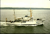 McArthur |
Eittreim, S.L., and Noble, M., 2002, Seafloor geology and natural environment of the Monterey Bay National Marine Sanctuary: Marine Geology, v. 181 no. 1-3, pp. 1–2, doi: 10.1016/S0025-3227(01)00258-4.
Wong, F., and Eittreim, S., 2001, Continental Shelf GIS for the Monterey Bay National Marine Sanctuary: U.S. Geological Survey Open-File Report 01-179, http://pubs.usgs.gov/of/2001/0179/.
| Survey Equipment | Survey Info | Data Type(s) | Data Collected |
|---|---|---|---|
| digitalcamera | --- | Photo | |
| dartcore | --- | Geology | Station Information |
| underwatertelevision | --- | Video | Survey information |
| YoNav | --- | Navigation | |
| underwatercamera | --- | Photo | Station Information |
| GPS | --- | Navigation | Best file with nav in ArcInfo E00 format Global positioning system (GPS) data m-1-98-mb.060 (Provisional best file) Global positioning system (GPS) data m-1-98-mb.060_degree Lines Survey information |
| integratednavigation | --- | Navigation | Survey information |
| clamshellgrab | --- | Geology | Station Information |
| VanVeengrab | --- | Geology |
