AKA: none
Other ID: M-1-99-SC
Status: Completed
Organization(s): USGS, Pacific Coastal and Marine Science Center
Funding Program(s):
Principal Investigator(s): Guy Cochrane
Affiliate Investigator(s):
Information Specialist(s): Guy Cochrane
Data Type(s): Imagery: Photo, Imagery: Video, Location-Elevation: Navigation, Sampling: Biology, Sampling: Geology, Sonar: Sidescan
Scientific Purpose/Goals:
Vehicle(s):
Start Port/Location:
End Port/Location:
Start Date: 1999-05-25
End Date: 1999-06-04
Equipment Used: submersible, GPS, sidescansonar
Information to be Derived:
Summary of Activity and Data Gathered:
Staff:
Affiliate Staff:
Notes: Associated cruises in southern California: B-1-98-SC B-1-99-SC B-2-99-SC M-1-99-SC M-1-00-SC J-1-02-SC M-1-02-SC M-1-03-SC S-5-04-SC
Staff information imported from InfoBank
Guy Cochrane (USGS Western Region) - Chief Scientist
Location:
Southern California
| Boundaries | |||
|---|---|---|---|
| North: 34.41336 | South: 33.90913 | West: -119.723 | East: -119.20769 |
Platform(s):
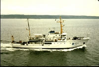 McArthur |
| Survey Equipment | Survey Info | Data Type(s) | Data Collected |
|---|---|---|---|
| submersible | --- | Photo Video Biology Geology | |
| GPS | --- | Navigation | Best file with nav in ArcInfo E00 format Global positioning system (GPS) data m-1-99-sc.060 (Provisional best file) Global positioning system (GPS) data m-1-99-sc.060_degree |
| sidescansonar | --- | Sidescan | Survey information File list |
