AKA: none
Other ID: M-2-01-GM,MW-1-01-GM
Status: Completed
Organization(s): National Oceanic and Atmospheric Administration, C&C Technologies, Inc., University of New Brunswick, Interactive Visualization Systems, USGS, Pacific Coastal and Marine Science Center, University of New Hampshire
Funding Program(s): Pacific Seafloor Mapping Project (ZP000LD)
Principal Investigator(s): Jim Gardner
Affiliate Investigator(s):
Information Specialist(s): Peter Dartnell
Data Type(s): Sonar: Multibeam
Scientific Purpose/Goals: Map the region between the 50 to 150-m isobaths south from the eastern edge of De Soto Canyon as far as Steamboat Lumps. These data should prove extremely useful in relating dominant species groups (which display highly specific biotope affinities) to the geomorphology (e.G., reef flattop, forereef crest, reef wall, reef base, circum-reef talus zone, circum-reef, high-reflectivity sediment apron, etc.)
Vehicle(s):
Start Port/Location: Panama City, FL
End Port/Location: Panama City, FL
Start Date: 2001-09-03
End Date: 2001-10-12
Equipment Used: multibeam
Information to be Derived: Bathymetry and calibrated, co-registered acoustic backscatter
Summary of Activity and Data Gathered:
Staff: Peter Dartnell, Larry Mayer
Affiliate Staff:
Brian Calder (University of New Hampshire) - Watch Stander
John Hughes (Watch Stander
University of New Brunswick) - Clark
Anya Duxfield (University of New Brunswick) - Watch Stander
Mark Paton (Interactive Visualization Systems) - Watch Stander
Michael Annis (NOAA) - Watch Stander
Garret Duffy (University of New Brunswick) - Watch Stander
Art Kleiner (C&C Technologies
Inc.) - C&C Party Chief
Dave Fitts (C&C Technologies
Inc.) - C&C Party Chief
Ryan Larson (C&C Technologies
Inc.) - Surveyor
Wes Kitt (C&C Technologies
Inc.) - Surveyor
Eric Ortego (C&C Technologies
Inc.) - Surveyor
Heather Carnocki (C&C Technologies
Inc.) - Surveyor
Notes:
Staff information imported from InfoBank
Jim Gardner (USGS Western Region) - Chief Scientist
Pete Dartnell (USGS Western Region) - Watch Stander
Larry Mayer (University of New Hampshire) - Watch Stander
Brian Calder (University of New Hampshire) - Watch Stander
John Hughes (Watch Stander, University of New Brunswick) - Clark
Anya Duxfield (University of New Brunswick) - Watch Stander
Mark Paton (Interactive Visualization Systems) - Watch Stander
Michael Annis (NOAA) - Watch Stander
Garret Duffy (University of New Brunswick) - Watch Stander
Art Kleiner (C&C Technologies, Inc.) - C&C Party Chief
Dave Fitts (C&C Technologies, Inc.) - C&C Party Chief
Ryan Larson (C&C Technologies, Inc.) - Surveyor
Wes Kitt (C&C Technologies, Inc.) - Surveyor
Eric Ortego (C&C Technologies, Inc.) - Surveyor
Heather Carnocki (C&C Technologies, Inc.) - Surveyor
Location:
Northeast Gulf of Mexico
| Boundaries | |||
|---|---|---|---|
| North: 30.75 | South: 24.25 | West: -91.75 | East: -80.25 |
Platform(s):
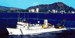 Moana Wave |
| Survey Equipment | Survey Info | Data Type(s) | Data Collected |
|---|---|---|---|
| multibeam | --- | Multibeam |
