AKA: none
Other ID: M-2-76-WO,MIL276WO
Status: Completed
Organization(s): USGS, Pacific Coastal and Marine Science Center
Funding Program(s):
Principal Investigator(s): Parke Snavely
Affiliate Investigator(s):
Information Specialist(s):
Data Type(s): Seismics: Boomer, Location-Elevation: Navigation
Scientific Purpose/Goals: To provide information on the thickness and distribution of Quaternary deposits to identify structures that deform them, and to provide a basis for assessing geo-environmental hazards.
Vehicle(s):
Start Port/Location:
End Port/Location:
Start Date: 1976-12-06
End Date: 1976-12-11
Equipment Used: uniboom, radar, transponder
Information to be Derived:
Summary of Activity and Data Gathered: Approximately 200 km of high-resolution seismic reflection profiles were recorded in the environs of Hood Canal and southern Puget Sound, WA. Tracklines were located by a combination of precision transponder navigation system and ships radar with variable range marker.
Staff: Howard Gower, Dick Tagg, Diane Lander, Robert Stacey
Affiliate Staff:
J.C. Yount - Unspecified
J.W. Lee - Unspecified
Notes:
Staff information imported from InfoBank
Parke Snavely (USGS Western Region) - Chief Scientist
Howard Gower - Unspecified
J.C. Yount - Unspecified
Dick Tagg - Unspecified
J.W. Lee - Unspecified
Diane Lander - Unspecified
Robert Stacey - Captain
Location:
Washington
| Boundaries | |||
|---|---|---|---|
| North: 50 | South: 41 | West: -131.25 | East: -122.25 |
Platform(s):
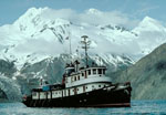 Don J. Miller II |
| Survey Equipment | Survey Info | Data Type(s) | Data Collected |
|---|---|---|---|
| uniboom | --- | Boomer | |
| radar | --- | Navigation | |
| transponder | --- | Navigation |
