AKA: none
Other ID: M-3-65-EG,SHOOT_2
Status: Completed
Organization(s): USGS, Pacific Coastal and Marine Science Center
Funding Program(s): Earthquake Hazards Project (MU090)
Principal Investigator(s): Gene Rusnak
Affiliate Investigator(s):
Information Specialist(s):
Data Type(s): Location-Elevation: Navigation, Sonar: Single Beam, Sampling: Geology, Environmental Data: Sediment Properties, Seismics: Sparker
Scientific Purpose/Goals: To obtain evidence from bathymetry, subbottom profiling, sediment distribution, and related features around the Prince William Sound area which could be ascribed to the causes and the results of the devastation on the earthquake-affected shores and seafloors following the 27 March 1964 Earthquake.
Vehicle(s):
Start Port/Location:
End Port/Location:
Start Date: 1965-09-05
End Date: 1965-09-07
Equipment Used: navigation equipment, bathymetry, gravitycore, Shipekgrab, Dill-Moorevaneshear, Sonoprobe, sparker
Information to be Derived: High energy subbottom profiling, sediment sampling, bathymetry.
Summary of Activity and Data Gathered:
Staff:
Affiliate Staff:
Notes: Staff information imported from InfoBank
Gene Rusnak (USGS Western Region) - Chief Scientist
Location:
Eastern Gulf of Alaska
| Boundaries | |||
|---|---|---|---|
| North: 61.75 | South: 57.25 | West: -144 | East: -132 |
Platform(s):
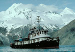 Don J. Miller II |
| Survey Equipment | Survey Info | Data Type(s) | Data Collected |
|---|---|---|---|
| navigation equipment | --- | Navigation | |
| bathymetry | --- | Single Beam | |
| gravitycore | --- | Geology | |
| Shipekgrab | --- | Geology | |
| Dill-Moorevaneshear | --- | Sediment Properties | |
| Sonoprobe | --- | Sediment Properties | |
| sparker | --- | Sparker |
