AKA: none
Other ID: M-4-88-PH,MW8804
Status: Completed
Organization(s):
Funding Program(s):
Principal Investigator(s): Steve Lewis
Affiliate Investigator(s):
Information Specialist(s):
Data Type(s): Sonar: Single Beam, Electro-Magnetic: Gravity, Electro-Magnetic: Magnetics, Location-Elevation: Navigation
Scientific Purpose/Goals:
Vehicle(s):
Start Port/Location:
End Port/Location:
Start Date: 1988-04-01
End Date: 1988-04-15
Equipment Used: bathymetry, gravity, magnetics, navigation
Information to be Derived:
Summary of Activity and Data Gathered:
Staff:
Affiliate Staff:
Notes: SeaMARC II side-scan, USGS/Cornell University, UNOLS/HIG/NGDC
Staff information imported from InfoBank
Steve Lewis (USGS Western Region) - Chief Scientist
Location:
Philippine Islands
| Boundaries | |||
|---|---|---|---|
| North: 14.56948 | South: 11.5901 | West: 120.4887 | East: 126.50676 |
Platform(s):
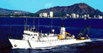 Moana Wave |
Sarewitz, D.R., and Lewis, S.D., 1991, The Marinduque intra-arc basin, Philippines: Basin genesis and in situ ophiolite development in a strike-slip setting: Geological Society of America Bulletin, v. 103 no. 5, pp. 597–614, doi: 10.1130/0016-7606(1991)103<0597:TMIABP>2.3.CO;2.
