AKA: 2010-054-FA
Other ID: M-54-10-AR
Status: Completed
Organization(s): USGS, Pacific Coastal and Marine Science Center, USGS, Woods Hole Coastal and Marine Science Center
Funding Program(s):
Principal Investigator(s): Robert Anders
Affiliate Investigator(s): Carolyn Ruppel (USGS Woods Hole)
Information Specialist(s):
Data Type(s): Seismics: Sonobuoy
Scientific Purpose/Goals: 1) Image seafloor 2) Map top of subsea permafrost in very near shore 3) Survey for possible methane emissions at distal inferred end of permafrost offshore 4) Collect data to help constrain whether seaward limit of permafrost is 'real' or related to a lithologic change
Vehicle(s):
Start Port/Location:
End Port/Location:
Start Date: 2010-08-03
End Date: 2010-08-09
Equipment Used: Sonobuoy
Information to be Derived:
Summary of Activity and Data Gathered:
Staff:
Affiliate Staff:
Notes: changed FAN to M5410AR on 10/18/2018
created FACS ID for data in FAD 8/3/2017
Methane Hydrate - Dept. of Energy;
Days at Sea: 6;
Project Maximum Weekly Overtime for Each: 36;
Overtime should NOT be charged to 0fp59;
Charge 0fp10 for overtime (USGS OE);
Seven or More Days With No Port Call: No;
Major Center Equipment Required:
Navigation - GPS,Seismic reflection,Seismic reflection -
sparker,Humminbird fishfinder;
Equipment Required from Other Sources:
sonobuoys (to be provided by Menlo Park);
Degree of Certainty: 85% pending permits;
Permitting:
NEPA CX in progress with Reston,
NMFS Letter of Concurrence request submitted,
FWS letter for ESA birds obtained,
FWS MMPA/ESA polar bear consultation underway,
Tribal council mtg interaction on 19 June 2010,
North Slope Borough permit application to be submitted by 27 June,
discussion started with private sector operator that may be in study area
during the survey on a ~70 m vessel;
Report Date: 2010-06-25;
Platform formerly MMS RV 1273.
Location:
Harrison Bay, Beaufort Sea, AK
| Boundaries | |||
|---|---|---|---|
| North: 72.13804838 | South: 67.76042494 | West: -156.4453125 | East: -134.921875 |
Platform(s):
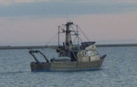 BOEM Launch 1273 |
| Survey Equipment | Survey Info | Data Type(s) | Data Collected |
|---|---|---|---|
| Sonobuoy | --- | Sonobuoy |
