AKA: none
Other ID: M-6-77-NP,Francis_Drake_VI
Status: Completed
Organization(s):
Funding Program(s): Hydrothermal System of the East Pacific Rise (MU144)
Principal Investigator(s): Bill Normark
Affiliate Investigator(s):
Information Specialist(s):
Data Type(s): Imagery: Photo, Location-Elevation: Navigation, Seismics: Sub Bottom Profiler, Sonar: Sidescan, Sonar: Single Beam
Scientific Purpose/Goals:
Vehicle(s):
Start Port/Location:
End Port/Location:
Start Date: 1977-01-01
End Date: 1977-01-01
Equipment Used: 20khz, 4khz, 12khz, 3.5khz, underwatercamera, side scan sonar, navigation
Information to be Derived:
Summary of Activity and Data Gathered:
Staff:
Affiliate Staff:
Fred Spiess - Unspecified Investigator
J.C. MacDonald - Unspecified Investigator
Notes: Staff information imported from InfoBank
Fred Spiess - Unspecified Investigator
J.C. MacDonald - Unspecified Investigator
Bill Normark (USGS Western Region) - Chief Scientist
Location:
Northern Pacific
| Boundaries | |||
|---|---|---|---|
| North: 35.32569495 | South: -8.8551595 | West: -121.2344 | East: -100.5625 |
Platform(s):
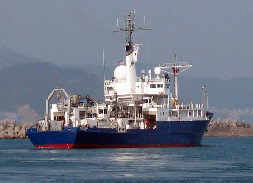 Melville |
Ballard, R.D., Francheteau, J., Juteau, T., Rangan, C., and Normark, W.R.,, 1981, East Pacific Rise at 21 degrees N; the volcanic, tectonic, and hydrothermal processes of the central axis: Earth and Planetary Science Letters, v. 55 no. 1, pp. 1–10.
Hess, G.R., and Normark, W.R., 1980, Possible geometries of sandstone bodies as reflected by geomorphic features on modern submarine fans: American Association of Petroleum Geologists Bulletin, v. 64 no. 5, pp. 722–723.
Hess, G.R., Lawhead, B., Lichtman, G.S., MacDonald, K.C., Miller, S.M., Normark, W.R., and Spiess, F.N., 1980, Fine-scale bathymetry used for submersible studies of the East Pacific Rise: U.S. Geological Survey Open-File Report 80-542, 2 p.
Lichtman, G.S., Normark, W.R., Spiess, F.N., and Hess, G.R., 1979, Detailed morphology and photogeology of the East Pacific Rise near lat. 21 degrees N: , Geological Society of America Abstracts with Programs. , pp. 466–466.
Lupton, J.E., Klinkhammer, G.P., Normark, W.R., Haymon, R., Macdonald, K.C., Weiss, R.F., and Craig, H., 1980, Helium-3 and manganese at the 21 degrees N East Pacific Rise hydrothermal site: Earth and Planetary Science Letters, v. 50 no. 1, pp. 115–127.
Normark, W.R., Alpha, T.R., Hess, G.R., Lichtman, G.S., and Gutmacher, C.E., 1978, Map showing the crest of the East Pacific Rise near the mouth of the Gulf of California: U.S. Geological Survey Open-File Report 78-350, 1 p.
Normark, W.R., and Bischoff, J.L., 1980, Hydrothermal activity and massive sulfides on the East Pacific Rise: U. S. Geological Survey Professional Paper 1175, pp. 163–163.
Normark, W.R., and Hess, G.R., 1979, Deep-tow studies of the East Pacific Rise off Mexico: U. S. Geological Survey Professional Paper 1150, pp. 157–157.
Normark, W.R., and Hess, G.R.,, 1978, Deep-tow studies of the East Pacific Rise, Pacific Ocean basin: U. S. Geological Survey Professional Paper 1100, pp. 158–158.
Normark, W.R., 1980, Definition of the plate boundary along the East Pacific Rise off Mexico: Marine Geodesy, v. 4 no. 1, pp. 29–41.
Wilde, P., Chase, T.E., Holmes, M.L., Normark, W.R., and Thomas, J.A., 1977, Oceanographic data off Washington, 46 degrees to 49 degrees north including the Nitinat deep sea fan: Lawrence Berkeley Laboratory, Energy and Environment Division, no. 223, 1 p.
| Survey Equipment | Survey Info | Data Type(s) | Data Collected |
|---|---|---|---|
| 20khz | --- | Single Beam | |
| 4khz | --- | Sub Bottom Profiler | |
| 12khz | --- | Single Beam | |
| 3.5khz | --- | Sub Bottom Profiler | |
| underwatercamera | --- | Video Photo | Photos |
| side scan sonar | --- | Sidescan | 195515 164 21 22 LINE RT SIDE LOOKER 195515 165 01 07 LINE LSLS 195515 165 05 16 LINE RSLS 195515 166 05 16 LINE LSLS 195515 166 18 01 LINE RSLS 195515 166 18 56 LINE LSLS 195515 167 05 35 LINE LEFT SLS 195515 167 07 MIN LINE RIGHT SIDE LOOKER 195515 168 10 26 LINE RSL 195515 168 10 31 LINE L SLS J21 195515 168 16 27 LINE LSLS 195515 168 16 27 LINE RSLS 195515 171 11 45 LINE RT SL |
| navigation | --- | Navigation |
